Majang Multipurpose Water Resources Development ProjectBIP_ENTRO_008
Majang development project is located in the Dunchaye kebele within the Godere woreda (Majang zone) Gambela Region, Ethiopia. The Majang Project, which will draw water from the Duchaye River, has…
WaterEthiopiaNorth-Eastern AfricaENTRO
$14MFeasibilityActive
52
Lomahasha / Namaacha Cross Border Potable Water Supply Project
Preparation of preliminary/detailed designs and construction of Phase II of Lomahasha and Siteki (Phase II in Swaziland),and Namaacha Water Supply Project. This phase will ensure water supply to the Lomahasha…
WaterEswatini, MozambiqueSouthern Africa
$14MFeasibilityActive
53
Amala Norera Multipurpose Storage ReservoirBIP_NELSAP_010
The Amala-Norera WRD Project seeks to promote sustainable water management practices that balance the needs of various water users, including agriculture, livestock, and domestic use. The Project is part of…
WaterKenyaEast Africa2024-01-NRBIP
$13MProject StructuringActive
54
Integrated Watershed Management in Dinder/Alitash national park sub-catchmentBIP_ENTRO_014
The Alatish-Dinder Transboundary Park Project was one of 13 potential first-round investment projects identified in 2007 under the Cooperative Regional Assessment (CRA) of Watershed Management in the Eastern Nile Basin.…
WaterEthiopia, SudanNorth-Eastern AfricaENTRO
$12MPre-FeasibilityActive
55
Integrated Watershed Management Project in Atbara CatchmentBIP_ENTRO_015
The Dinder, Atbara and Bau Watershed Management Project is one of the four fast track projects prepared in 2007 under the Eastern Nile Watershed Management (ENWM) Project. Three watersheds were…
WaterEthiopiaNorth-Eastern AfricaENTRO
$12MFeasibilityActive
56
Integrated Mukungwa wetland and landscape restoration projectBIP_LVBC_009
The Project aims to transform the Mukungwa Wetland into an urban wetland recreation and eco-tourism park with view to increase biodiversity, reduce flood risk and manage pollution. The project will…
WaterRwandaEast Africa2024-01-NRBIP
$11MTransaction Support & Financial CloseActive
57
Faecal Sludge and Solid Waste Management Project in Small Towns of Kyazanga and Kalangala IslandBIP_LVBC_005
The Faecal Sludge Solid Water Management project in the small towns of Kyazanga and Kalangala aims to establish sustainable, safe, and efficient faecal sludge management (FSM) systems to reduce illegal…
WaterUgandaEast Africa2024-01-NRBIP
$10MFeasibilityActive
58
Transboundary Hydro-Meteorological and Environmental Monitoring System and Environmental Flows Assessment
Transboundary Hydro-Meteorological and Environmental Monitoring System and Environmental Flows Assessment Project is one of nine medium and long-term projecs identified and prioiritized under the Baro-Akobo-Sobat (BAS) Multipurpose Water Resources Study…
WaterEthiopia, South Sudan, SudanNorth-Eastern AfricaENTRO
$10MFeasibilityActive
59
Increase Muvumba's and Base's Community Resilience through Participatory and Ecosystem-based Catchment RestorationBIP_LVBC_008
The project aims to enhance climate and environmental resilience in the Muvumba and Base river catchments, covering communities in Nyagatare, Rulindo, Gakenke, and Burera districts. It targets 40,000 direct beneficiaries…
WaterRwandaEast Africa2024-01-NRBIP
$10MFeasibilityActive
60
Iullemeden Aquifer SystemW.09.01
The IAS faces multiple constraints; in particular difficulties of access to water resources related to the excessive depth (over 600 m) in some regions. Moreover, the lack of sub-regional strategic…
WaterMali, Niger, NigeriaWest Africapap1
$9MPre-FeasibilityActive
61
Construction of Trunk Sewer and Industrial Wastewater Treatment Plant (WWTP) at Nyakato Area.
The industrial WWTP is estimated to treat 7,500m3/day which will treat total amount of waste water produced from the existing Industries. The system is proposed to have anaerobic ponds followed…
WaterNR-BIP-001-24-LVBC-001
$9MActive
62
Telkuk Water Harvesting ProjectBIP_ENTRO_022
Telkuk Water Harvesting Project Telkuk Water
Harvesting Project is to promote the sustainable management of rangeland in the
Talkuk Locality, Kassala State. Proposed project interventions include:
Increasing
water harvesting through constructing traditional teras, libish,…
WaterSudanNorth-Eastern AfricaENTRO
$8MPre-FeasibilityActive
63
Akobo-Gambella Floodplains Transboundary Development ProgrammeBIP_ENTRO_007
The Akobo-Gambella floodplains transboundary development programme is one of the three short term projects proposed as part of the Baro-Akobo-Sobat multipurpose water resources development study project. The three short term…
WaterEthiopia, South Sudan, SudanNorth-Eastern AfricaENTRO
$8MFeasibilityActive
64
Sudd Wetlands Management Plan
The Sudd wetland is one of the most unique and valuable ecosystems on Earth. It is the largest wetland in Africa, and a designated a Ramsar site. The Sudd wetlands…
WaterEgypt, Ethiopia, Kenya, South Sudan, Sudan, UgandaEast Africa, North Africa, North-Eastern AfricaENTRO
$6MProject DefinitionActive
65
Construction for Faecal sludge treatment plant in Huye TownBIP_LVBC_003
The Faecal Sludge Treatment Plant (FSTP) project for Huye Town is designed to close a major sanitation gap affecting its 256,148 inhabitants, who rely predominantly on on site sanitation systems…
WaterRwandaEast Africa2024-01-NRBIP
$5MFeasibilityActive
66
Construction for Faecal Sludge Treatment Plant in Muhanga TownBIP_LVBC_004
The construction of the Faecal Sludge Treatment Plant (FSTP) in Muhanga Town is designed to address the growing need for effective and sustainable faecal sludge management by providing a dedicated…
WaterRwandaEast Africa2024-01-NRBIP
$5MFeasibilityActive
67
Strengthening the capacity of IGAD towards enhanced drought resilience in the HoA - SCIDAII
Operationalisation of São Tomé and Príncipe Hydrometric StationsW.30.13
São Tomé and Príncipe has 12 automatic hydrometric stations that require maintenance, calibration, reliable communications and improved data management to operate effectively. The project will restore the network, provide satellite…
WaterSao Tome and PrincipeWest Africa2020
$2MFeasibilityActive
69
Lwakhakha Cross Border Storm Water Drainage and Solid Waste ManagementBIP_NELSAP_025
WaterKenya, UgandaEast Africa2024-01-NRBIP
$1MFeasibilityActive
70
Integrated BAS Hydropower, Irrigation and Multipurpose Development Programme - Phase 1: Baro/Sobat Component.BIP_ENTRO_003
Integrated BAS Hydropower, Irrigation and Multipurpose Development Programme - Phase 1: Baro/Sobat Component.’ is one of nine priority medium to long-term projects under the Integrated Water Resources Development and Management…
WaterEthiopia, South Sudan, SudanNorth-Eastern AfricaENTRO
$1MPre-FeasibilityActive
71
Integrated Watershed Management in Priority Catchment (Dinder/Rahad Watersheds Management Projects)BIP_ENTRO_013
Dinder and Rahad Rivers originate in the Ethiopian Highlands and flow northwestwards before joining with the Abbay River downstream of Sennar dam to form the Blue Nile River. The two…
WaterSudanNorth-Eastern AfricaENTRO
$1MPre-FeasibilityActive
72
Review of Eastern Nile Livelihood Based Watershed Management programme - prioritizing interventions and taking to for scale for a basin wide impactBIP_ENTRO_018
Its main aim is to promote transboundary cooperation among Ethiopia, Sudan and South Sudan, to tackle watershed degradation, reduce sedimentation, and foster sustainable livelihoods and food security. The Baro-Akobo-Sobat IWRDMPlan's…
WaterEthiopia, South Sudan, SudanNorth-Eastern AfricaENTRO
$1MFeasibilityActive
73
Using Solar and Wind Energy to Extract Groundwater in Pastoral WellsW.30.12
The project will install renewable-energy-powered pumping systems on 15 pastoral wells in the western Jafara Plain. Solar and wind systems would enable sustainable groundwater abstraction for livestock watering, pasture development,…
WaterLibya, TunisiaNorth Africa2020
$0MEnabling Environment and Needs AssessmentActive
74
Agriculture and Climate Risk Management in the Lake Victoria Basin Programme
The programme will contribute to the reduction of emissions estimated to be 149,505,100 tCO2-eq. This estimation is based on 2006 IPCC Guidelines for National Greenhouse Gas Inventories and National…
Not reportedEnabling Environment and Needs AssessmentActive
75
Akobo â€" Pibor transboundary multipurpose development project
Akobo and Pibor Rives that are shared by Ethiopia and South Sudan have a lot of potential to support socio-economic development, including hydropower generation, agricultural irrigation, fisheries resoures development and…
WaterEthiopia, South SudanNorth-Eastern AfricaENTRO
Not reportedPre-FeasibilityActive
76
Baro Akobo Sobat Multipurpose water resources study
Short-Term, Medium, and long-term projects identified.
WaterZ1.00.00
Not reportedCompleted
77
Boma-Gambella Transboundary National Park
Gambela National Park (GNP) (4,575 km2) â€" the largest protected area in Ethiopia â€" is located in south western Ethiopia adjacent to the border with South Sudan. Located south of…
WaterEthiopia, South SudanNorth-Eastern AfricaENTRO
Not reportedPre-FeasibilityActive
78
Butana Plains Watershed Management Project
The Butana Plains Watershed Management Project was one of 13 potential first-round investment projects identified in 2007 under the Cooperative Regional Assessment (CRA) of Watershed Management in the Eastern Nile…
WaterSudanNorth-Eastern AfricaENTRO
Not reportedPre-FeasibilityActive
79
Cingaineta River Multipurpose Development Project
Cingaineta River originates in the Didinga foothills of the Imatong Mountains close to the South Sudan â€" Uganda border, and flows through the town of Kapoeta in in Eastern Equatoria…
WaterSouth SudanNorth-Eastern AfricaENTRO
Not reportedPre-FeasibilityActive
80
Construction of the Dam and Development of the Palambo Hydroelectric PlantW.30.03
The project comprises a dam at the Palambo Rapids on the Oubangui River and an associated hydroelectric plant serving Bangui and neighbouring areas of the Republic of the Congo and…
WaterCentral African Republic, Democratic Republic of Congo, Republic of CongoCentral Africa2020
Not reportedFeasibilityActive
81
Eastern Nile Transboundary Water Quality Monitoring Programme
Rapid population increase coupled with expanding agriculture, urbanisation, industrialisation, aging waste water treatment infrastructure and expansion of irrigation schemes in the Eastern Nile pose a serious threat to water quality…
WaterEgypt, Ethiopia, South Sudan, SudanNorth Africa, North-Eastern AfricaENTRO
Not reportedPre-FeasibilityActive
82
Feasibility and In-depth Studies on the Development of Lake ChadW.30.07
The project is a coordinated feasibility, technical-study and action-programme package for Lake Chad and its principal tributaries. It addresses poorly quantified sedimentation and siltation, invasive aquatic vegetation, unequal water distribution…
WaterCameroon, Central African Republic, Chad, Niger, NigeriaCentral Africa, West Africa2020
Not reportedFeasibilityActive
83
Fomi Multi-purpose Dam (Niger River Basin)W.02.01
Construction of a dam and hydroelectric plant of 90 MW on the Niandan River in Guinea with a reservoir of about 5 billion m3 of water.
The project has two components,…
WaterGuinea, Mali, Niger, NigeriaWest Africapap1
Not reportedFeasibilityActive
84
Gambella - Machar Transboundary National Park Environmental Protection Project
Gambella National Park (GNP) (5,060 km2) â€" the largest protected area in Ethiopia â€" is located in southwestern Ethiopia adjacent to the border with South Sudan. The park consists of…
WaterEthiopia, South SudanNorth-Eastern AfricaENTRO
Not reportedPre-FeasibilityActive
85
Jema Integrated Watershed Management Project
The Jema sub-basin measures 3,241 km2 in area, and is part of the Abbay (Blue Nile) River Basin located in the Central Ethiopian Highlands. The sub-basin partially covers six woredas…
WaterEthiopiaNorth-Eastern AfricaZ1.00.00
Not reportedFeasibilityActive
86
Lake Victoria Basin Integrated Water Resources Management Programme
WaterZ1.00.00
Not reportedActive
87
North-West Sahara Aquifer System W.08.01
The NWAS is one of the major North African transboundary groundwater basins shared by three North African countries (i.e. i.e. Algeria, Libya, and Tunisia) which covers an area of more than…
WaterAlgeria, Libya, TunisiaNorth Africapap1
Not reportedProject StructuringActive
88
Noumbiel Multi-Purpose DamW.06.01
The Noumbiel Multi-purpose Dam is a planned infrastructure project on the Black Volta River, located on the border between Burkina Faso and Ghana. The project aims to construct a dam…
WaterBurkina Faso, GhanaWest Africapap1
Not reportedFeasibilityActive
89
Nubian Sandstone Aquifer SystemW.07.01
The Nubian Sandstone Aquifer System (NSAS) underlies the countries of Chad, Egypt, Libya and Sudan, the total population of which is over 136 million. It is the world’s largest ‘fossil’…
WaterChad, Egypt, Libya, SudanCentral Africa, North Africa, North-Eastern AfricaIGAD
Not reportedTenderingActive
90
Nyimur Multipurpose Water Resources Project Studies
The core scheme of the project consists of a 26 m head dam and reservoir on Nyimur River and five (5) modules of irrigated lowland rice of approximately 5,105 ha.…
The project aims to provide solutions to the problems of interruption of navigation on Oubangui River, tributary of the Congo River in the region of Central Africa. This is particularly the case during…
WaterCentral African Republic, Democratic Republic of CongoCentral Africapap1
Not reportedPre-FeasibilityActive
92
Rehabilitation and modernization of the existing Irrigation schemes (Ethiopia) Abbay/Blue Nile
There are more than 5.3 million ha of land currently under irrigation in the Eastern Nile, most with a poorThe project titled ‘Rehabilitation and modernization of the existing Irrigation schemes…
WaterEthiopiaNorth-Eastern AfricaENTRO
Not reportedPre-FeasibilityActive
93
Rehabilitation and modernization of the existing Irrigation schemes: Baro-Akobo-Sobat/White Nile
There are more than 5.3 million ha of land currently under irrigation in the Eastern Nile, most with a poorThe project identification was completed in 2015 with funding from the…
WaterEgypt, Ethiopia, South Sudan, SudanNorth Africa, North-Eastern AfricaENTRO
Not reportedPre-FeasibilityActive
94
Sor Watershed Project
Sor Watershed Project . The Sor River originates in the highland Montane Forests that straddle the Illubabor Administrative Zone of Oromiya Regional State and of Kaffa Administrative Zone in Southern…
WaterEthiopiaNorth-Eastern AfricaENTRO
Not reportedPre-FeasibilityActive
95
The Ruvyironza Multipurpose Water Resources Development Project
The development of the project will follow the guidelines for mainstreaming climate change adaptation into water resources development and management developed for the NBI to ensure that robust and resilient…
WaterZ1.00.00
Not reportedActive
96
Transboundary Watershed/Wetland Management Project (Sudan and Ethiopia)
This project will be located in the Blue Nile
Sub-basin covering among others the ecological significant watersheds of the
Dinder and Rahad Rivers. The two rivers originate in the Ethiopian Highlands
and flow…
WaterEthiopia, SudanNorth-Eastern Africa
Not reportedProject DefinitionActive
97
Upper Birbir (West) Watershed Project
Upper Birbir (West) Watershed Project Upper Birbir (West) Watershed Project is to promote the sustainable management of the natural resources of the watershed while exploiting them to support livelihoods of…
WaterEthiopiaNorth-Eastern AfricaENTRO
Not reportedPre-FeasibilityActive
98
Wadi Allaqi Livelihoods Support Project
Wadi Allaqi Livelihoods Support Project Wadi Allaqi Livelihoods Support Project is to promote alternative livelihood activities that protect the unique biodiversity of the area. Project interventions include promoting tree planting…
WaterEgyptNorth AfricaENTRO
Not reportedPre-FeasibilityActive
99
Wadi Allaqi/Gabgaba (Sudan) UNESCO Biosphere Reserve Baseline Studies
Wadi Allaqi/Gabgaba (Sudan) UNESCO Biosphere Reserve Baseline Studies The prefeasibility study for the project was carried out in the period 2010-2012 under the Watershed Delineation and Prioritization Project.
WaterEgyptNorth AfricaENTRO
Not reportedPre-FeasibilityActive
100
Water Diplomacy
WaterZ1.00.00
Not reportedActive
WaterBIP_ENTRO_008Majang Multipurpose Water Resources Development Project
EthiopiaNorth-Eastern AfricaENTRO
Majang development project is located in the Dunchaye kebele within the Godere woreda (Majang zone) Gambela Region, Ethiopia. The Majang Project, which will draw water from the Duchaye River, has four components, namely (a) micro-hydropower development for the remotely located area that is not connected to the national grid. A 0.16 MW power plant will be constructed that will generate 1 GWh/annum; (b) equipping 220 ha for irrigation; (c) construct 20 fish ponds, each of surface 200 m2; and training farmers in aquaculture; (d) improving watershed management through reforestation, rehabilitation of degraded areas, planting of fruit trees and supporting alternative livelihood activities like beekeeping.
 The Majang River Multipurpose Development Project is one of the three short term projects proposed as part of the Baro-Akobo-Sobat (BAS) Multipurpose Water Resources Development Study Project. The BAS Project itself was part of the initial 7 sub-projects of the Integrated Development of Eastern Nile (IEDN) Project. Activities under the project commenced in 2008-20012 funded with a seed grant from the Netherlands and French governments. Later on, project preparation activities were carried out with funding from the African Water Facility and NEPAD-IPPF. These included the feasibility study for the Majang Multipurpose project funded by the African Water Facility in 2015-2017.
WaterLomahasha / Namaacha Cross Border Potable Water Supply Project
Eswatini, MozambiqueSouthern Africa
Preparation of preliminary/detailed designs and construction of Phase II of Lomahasha and Siteki (Phase II in Swaziland),and Namaacha Water Supply Project. This phase will ensure water supply to the Lomahasha area in Swaziland and extending it to the Namaacha town in Mozambique through a memorandum of understanding for supply of water to communities residing along common borders of the two countries. It aims to supply a total population of 100 000 people with a safe drinking water supply and sanitation service as well as irrigating 1,000 hectares of land. The project aims to: - Improve health of the residents; - Promote economic activity; - Create employment opportunities; - Increase food security and reduction of poverty; and - Provide additional revenue for the water utilities. The project began as the Siteki Lomahasha water supply project, funded under the Government of Swaziland capital projects budget. Due to the financial constraints, the Corporation concentrated on the Siteki component which is now almost complete. Fiscal constraints also resulted in the suspension of the Lomahasha component, pending further identification of infrastructure funding possibilities.
The Amala-Norera WRD Project seeks to promote sustainable water management practices that balance the needs of various water users, including agriculture, livestock, and domestic use. The Project is part of the investment projects advanced by Kenya to NELSAP for project preparation. The project was included in the NELSAP Strategic Plan 2012 - 2016,
approved by the NEL Council of Ministers in January 2012. The project is prioritized by the Government of Kenya, and it is included in the National Water Masterplan, 2030. Pre-feasibility studies for Amala dam and feasibility studies for Norera dam were concluded in 2014.
The impact of the Amala-Norera WRD Project is significant. It will not only ensure a sustainable supply of water for the communities and livestock in Bomet and Narok Counties with population of 1,028,130 and 1,157,8733 but also improve the quality of water in the river, which is essential for the survival of aquatic life and the tourism industry, a critical source of income for both countries. The project will increase water availability for agriculture through development of 5,000Ha irrigation command area, hence improve food security and create new income opportunities for farmers. Moreover, by promoting sustainable water management practices, the project will contribute to reducing conflicts over water
resources and enhance the resilience of the communities to climate change.
WaterBIP_ENTRO_014Integrated Watershed Management in Dinder/Alitash national park sub-catchment
Ethiopia, SudanNorth-Eastern AfricaENTRO
The Alatish-Dinder Transboundary Park Project was one of 13 potential first-round investment projects identified in 2007 under the Cooperative Regional Assessment (CRA) of Watershed Management in the Eastern Nile Basin. The 13 projects identified under the CRA focused on watered degradation ‘hot spots’ characterized by increasing population pressure on a degrading natural resource base. The Alatish National Park (2,666 km2, Ethiopia), and Dinder National Park (8,960 km2, Sudan) are located along the Ethiopia-Sudan border and form a contiguous ecosystem with a high diversity of plant and animal species due to their location on the ecotone between the Sahel and Ethiopian Highlands eco-regions, and location along a major migratory bird flyway between Eurasia and Africa. The two parks are important for protecting the main sources of water for the Blue Nile, Dinder and Rahad Rivers. The biodiversity of the two parks is threatened by surrounding communities, among whom is a large number of internally displaced persons. Members of the surrounding communities in the two countries, who number over 150,000, encroach on the two parks to poach wildlife, graze and water livestock, cultivate crops, fish in the rivers in the park, collection of honey, cutting trees for firewood, and starting bush fires.
The objective of the Alatish-Dinder Transboundary Park Project is to support the coordinated sustainable management of the two parks and protection of their biodiversity. Project interventions include supporting coordination and network between the two governments and conservation NGOs in the two states; coordinated development of management plans for the two parks; capacity building for park officials; capacity building for local communities to engage in co-management of the parks; construction of tourism and patrol roads in the two parks; construction of park administrative buildings; conducing joint research and monitoring programmes
Prefeasibility studies were performed on the project in 2010-2012 under the Watershed Delineation and Prioritization Project and re-prioritized in 2015 under the Multi-Sectoral Investment Opportunities Assessment (MSIOA) conducted under the Nile Cooperation for Results (NCORE) Project.
WaterBIP_ENTRO_015Integrated Watershed Management Project in Atbara Catchment
EthiopiaNorth-Eastern AfricaENTRO
The Dinder, Atbara and Bau Watershed Management Project is one of the four fast track projects prepared in 2007 under the Eastern Nile Watershed Management (ENWM) Project. Three watersheds were selected for the Sudan Project based on a number of factors including community interest and prior experience, impact on poverty, chances for demonstrating early results of improved land and water management, and government support. The three watersheds were (i) Dinder National Park and surroundings; (ii) Lower Atbara, and (iii) the Bau locality.
The project objective was to stimulate, support and demonstrate alternative livelihood practices and local governance systems that contribute to poverty reduction and environmental sustainability. The three selected watersheds have different characteristics and needs and are located within different ecological zones. Area specific characteristics and objectives for the three watersheds were as follows:
           (DNP) Area â€" Features: remote and poorly connected area; degraded natural resources in the lands surrounding the Park; encroachment by surrounding communities on the Park natural resources (grazing of large herd sof livestock) leading to conflicts with park management; conflicts between different communities over natural resources; area prone to droughts and floods; previous experience with community participatory planning and development. Objective: To safeguard the natural resources and the biodiversity of the Dinder National Park by improving the Park management and enhance participatory planning and offering alternative livelihoods to target groups who at present depend on the park's natural resources
         â€" Features: desert area with low rainfall and scare natural resources; pronounced urban-rural interaction, limited mechanized farming, low environmental carrying capacity; substantial previous experience with community participatory planning and development. Objective: to combat desertification, improve environmental resilience and reduce people’s vulnerability by promoting more reliable and environmentally sound livelihoods to the people dependent on the scanty natural resources in the Lower Atbara.
         â€" Features: remote, poorly connected, war-stricken area; facing influx of people from IDPs; favourable precipitation and natural resources base; area prone to droughts and floods; land tenure distribution/management still ongoing; very limited experience with community participatory planning. Objective: to reduce the pressure on and conflicts over the natural resources, to capture the long-term development potential of the area, and to build a foundation for sustained peace by promoting alternative, more reliable and environmentally friendly livelihood practices.
The project had three components namely: (a) institutional strengthening; (b) project management; and (c) integrated watershed management and development (IWM&D) interventions. Specific interventions under the Project included strengthening capacity of supporting government institutions and stakeholder institutions; building capacity of Community-Based Organisations; construction of weirs with intake structures, construction of shallow wells, deep boreholes; construction of micro-and small dams for irrigation with diversion structures and distribution canals; construction of sand dams; construction of rainwater harvesting structures; improving farm production and farming systems through diversification and intensification of farming and farm infrastructure; improving grazing lands in wadis through water harvesting and reseeding with local legumes and seeds; reviving and improving animal migration routes; planting trees along animal migration routes for shade and browse; constructing livestock watering points and veterinary service centres, control of livestock pests and diseases; rehabilitating degraded parts of existing forests; controlling illegal logging, fires and grazing in protected areas; training local communities in forest management; introducing appropriate technology for small-scale miners to reduce their pollution impact; an diversification of income generating activities (fodder harvesting and packing; gum Arabic packing and marketing; dates grading and packing; vegetable and fruit processing; dairy processing; fish processing; wood handcraft making; mat making with camel wool; small scale metal fabrication; hand woven cotton fabric.
WaterBIP_LVBC_009Integrated Mukungwa wetland and landscape restoration project
RwandaEast Africa2024-01-NRBIP
The Project aims to transform the Mukungwa Wetland into an urban wetland recreation and eco-tourism park with view to increase biodiversity, reduce flood risk and manage pollution. The project will not only provide social and economic benefits to the communities but also support innovative approaches to restore and conserve wetland ecosystems on 130 Ha including its buffer zone of 30ha, restoration Mukungwa wetland catchment on 5000ha, promote the sustainable management of natural resources and support livelihood diversification to enhance incomes for local communities.
The Project specific objectives include:
- Wetland Restoration: Rehabilitating degraded wetlands to improve biodiversity and ecosystem services;
- Landscape Rehabilitation: Implementing soil and water conservation measures to prevent erosion and land degradation;
- Livelihood improvement: engaging local communities in restoration activities to ensure sustainability and ownership; and
- Eco-tourism Development: Establishing the Mukungwa Urban Eco-tourism Park to promote conservation awareness and generate alternative livelihoods.
WaterBIP_LVBC_005Faecal Sludge and Solid Waste Management Project in Small Towns of Kyazanga and Kalangala Island
UgandaEast Africa2024-01-NRBIP
The Faecal Sludge Solid Water Management project in the small towns of Kyazanga and Kalangala aims to establish sustainable, safe, and efficient faecal sludge management (FSM) systems to reduce illegal and hazardous dumping of faecal sludge and solid waste to the surrounding swamps and the Lake Victoria. The project focuses on the construction and operation of faecal sludge treatment and solid waste management facilities, incorporating safe containment, emptying, transportation, treatment, and disposal or reuse of faecal sludge aligned with Uganda's environmental and public health standards, and valorization of the end product from faecal sludge and solid waste.
Approximately 14,553 people in Kalangala and 59,908 people in Kyazanga (74,461 people) will benefit from the Project. By improving FSM infrastructure and service delivery, the project seeks to reduce environmental pollution, enhance public health, and improve the socio-economic conditions of local communities through better sanitation services. It also supports decentralized, inclusive solutions that integrate with existing water and sanitation frameworks, contributing to broader regional sanitation goals and sustainable urban development in Kyazanga and Kalangala.
WaterTransboundary Hydro-Meteorological and Environmental Monitoring System and Environmental Flows Assessment
Ethiopia, South Sudan, SudanNorth-Eastern AfricaENTRO
Transboundary Hydro-Meteorological and Environmental Monitoring System and Environmental Flows Assessment Project is one of nine medium and long-term projecs identified and prioiritized under the Baro-Akobo-Sobat (BAS) Multipurpose Water Resources Study Project that was implementd from 2015 to 2017. The Baro-Akabo-Sobat sub-basin, which consists of the Baro, Akobo and the Pibor rivers, has a catchment area of about 260,000 km2. The Baro River originates in the highlands of Ethiopia (2,000 â€" 3,500 masl) and flows northwest wards through Gambella plains (450 masl) into South Sudan. The Pibor River originates in the Imatong Mountains close to the South Sudan-Uganda border and flows nothwards through grassy flat plains. The Pibor is joined on its journey by the Akobo, Gilo and Alwero Rivers originating from the Ethiopian highlands. The Pibor river eventiually joints with the Baro River to form the Sobat River.Â
 The project identification was completed in 2015 with funding from the World Bank under the Nile Cooperation for Results Project (NCORE).
WaterBIP_LVBC_008Increase Muvumba's and Base's Community Resilience through Participatory and Ecosystem-based Catchment Restoration
RwandaEast Africa2024-01-NRBIP
The project aims to enhance climate and environmental resilience in the Muvumba and Base river catchments, covering communities in Nyagatare, Rulindo, Gakenke, and Burera districts. It targets 40,000 direct beneficiaries and more than 500,000 indirect beneficiaries, many of whom rely on the catchment for agriculture, water supply, and ecosystem services. By addressing severe land degradation, erosion, and declining watershed productivity, the project seeks to secure livelihoods and protect essential natural resources.
Central to the intervention is the restoration of 10,000 hectares of degraded land using ecosystem based and participatory land husbandry techniques. The project focuses on reducing soil erosion by at least 50%, strengthening local ownership, and encouraging co financing mechanisms such as Payment for Ecosystem Services (PES). It also aims to create at least 2,000 green rural jobs, improve management of fragile landscapes, and protect critical infrastructure such as roads and bridges from siltation and runoff.
It will build capacity within communities through participatory planning tools such as Village Land Use Action Plans and micro catchment action plans. Ultimately, the intervention aims to strengthen long term ecosystem services, improve local livelihoods, and contribute to regional water security for downstream users, including hydropower companies and communities relying on wetland ecosystems.
WaterW.09.01Iullemeden Aquifer System
Mali, Niger, NigeriaWest Africapap1
The IAS faces multiple constraints; in particular difficulties of access to water resources related to the excessive depth (over 600 m) in some regions. Moreover, the lack of sub-regional strategic water resources management has led to changes in aquifer hydro-dynamics and water quality degradation. It constitutes the main perennial resource of potable water and a strategic resource for the sustainable development of the concerned countries.
WaterConstruction of Trunk Sewer and Industrial Wastewater Treatment Plant (WWTP) at Nyakato Area.
NR-BIP-001-24-LVBC-001
The industrial WWTP is estimated to treat 7,500m3/day which will treat total amount of waste water produced from the existing Industries. The system is proposed to have anaerobic ponds followed by facultative ponds that will discharge into the constructed wetlands that are believed to work more efficiently compared to the maturation ponds. The innovation here is that effluent from the constructed wetlands will be discharge to the farm that are introduced as part of alternative activities aimed to reduce human activities along the Lake Victoria shoreline
WaterBIP_ENTRO_022Telkuk Water Harvesting Project
SudanNorth-Eastern AfricaENTRO
Telkuk Water Harvesting Project Telkuk Water
Harvesting Project is to promote the sustainable management of rangeland in the
Talkuk Locality, Kassala State. Proposed project interventions include:
Increasing
water harvesting through constructing traditional teras, libish, and small
dams; delineating wild flooding areas; multiplying local grass varieties and
forage trees with re-seeding and planting them to improve rangelands,
construction of livestock watering points in rangelands and along stock
migration routes, rehabilitation of existing hafirs, improvement of livestock
market infrastructure; training of para-veterinary workers; supporting
participatory landuse planning; promoting off-farm income generating
activities, supporting formation of savings and credit cooperatives (SACCOs),
improving processing of agricultural products.
The
prefeasibility study for the project was carried out in the period 2010-2012
under the Watershed Delineation and Prioritization Project.
WaterBIP_ENTRO_007Akobo-Gambella Floodplains Transboundary Development Programme
Ethiopia, South Sudan, SudanNorth-Eastern AfricaENTRO
The Akobo-Gambella floodplains transboundary development programme is one of the three short term projects proposed as part of the Baro-Akobo-Sobat multipurpose water resources development study project. The three short term projects are based on the sustainable development of water resources. They aim at providing inter-sectoral benefits and improving people's livelihoods in the sub-basin. The Akobo-Gambella programme is designed around solar pumping and the provision of water for various uses. This programme is designed to reduce extreme poverty and improve livelihoods in an area of the BAS sub-basin which is highly vulnerable (conflicts over the resources, food insecurity, no access to a safe source of water, etc.). This area currently receives humanitarian aid and the programme focuses on the transition between aid and development. The programme includes generic components such as potable water supply, sanitation, livestock watering, capture fisheries, aquaculture, small scale irrigation and capacity building. The implementation of the programme will include field work to select pilot areas, identify specific needs and refine these generic components.
Akobo-Gambella Floodplains Transboundary Development Programme covers parts of the Baro-Akobo-Sobat basin in Ethiopia and South Sudan. In Ethiopia, the programme focuses on the plains of Gambella region (Nuer Zone) and in South Sudan, it is located in Jonglei State (Akobo County) and Upper Nile State (Ulang County). The Programme is located in an area that is highly vulnerable and suffers from frequent conflicts over natural resources, food insecurity, no access to a safe water, etc., and is heavily dependent on humanitarian aid. The Akobo-Gambella Programme aims to facilitate a transition from aid dependency to self-sufficiency in food and other basin services. The objective of the programme is to reduce transboundary conflicts associated with water, improve food security and lead to improved livelihoods. The programme comprises of several generic components such as potable water supply, sanitation, livestock watering, capture fisheries, aquaculture, small scale irrigation and capacity building. The implementation of the programme will include field work to select pilot areas, identify specific needs and refine these generic components. The basic approach of the programme is to abstract water from the ground and rivers using solar-powered pumps, transfer it to storge tanks, and from there distribute it for multiple purpose including domestic water supply and sanitation, small scale irrigation, livestock watering and aquaculture. The water sources and pumping systems could be different for each of the uses. Hardware interventions will be complemented by software interventions such as hygiene education, training on fish farming, training on operation and maintenance of water infrastructure, and awareness on watershed management. The indicated costs below are for interventions in a single village.
 The Akobo-Gambella Floodplains Transboundary Development Programme is one of the three short term projects proposed as part of the Baro-Akobo-Sobat (BAS) Multipurpose Activities under the project commenced in 2008-20012 funded with a seed grant from the Netherlands and French governments. The feasibility study for the Akobo-Gambella Floodplains Transboundary Development Programme was funded by the African Water Facility and carried out in 2015-2017.
WaterSudd Wetlands Management Plan
Egypt, Ethiopia, Kenya, South Sudan, Sudan, UgandaEast Africa, North Africa, North-Eastern AfricaENTRO
The Sudd wetland is one of the most unique and valuable ecosystems on Earth. It is the largest wetland in Africa, and a designated a Ramsar site. The Sudd wetlands are of critical importance to South Sudan and the wider region through two competing factors â€" the value of the oil deposits below them, and the important ecosystem services they currently provide.
The Sudd is an important environmental resource that supports large populations of wildlife (including endangered and endemic species) rich and abundant fish populations, and around 1 million people whose engage in agriculture, fishing and livestock husbandry for livelihoods. The Suud is also pivotal in regulating the weather patterns in the Sahel, the Horn of Africa and the greater East Africa region and acts as a barrier to the southward encroachment of the Sahara desert, and in controlling the hydrology of the White and Main Niles. Due to decades of conflict in South Sudan, very little research has been undertaken on the Sudd, hence information to support its management is scanty. The region is suffering from impacts of climate change, which manifest as increasing frequency of extreme high inflows and rainfall, leading to cycles of expansion and contraction of the Sudd. An economic valuation study put the value of the Sudd at $3.3 billion based primarily to the climatic regulation, flood control and biodiversity services, but also through provisioning services including livestock grazing and watering, fishing, and papyrus crafts.
WaterBIP_LVBC_003Construction for Faecal sludge treatment plant in Huye Town
RwandaEast Africa2024-01-NRBIP
The Faecal Sludge Treatment Plant (FSTP) project for Huye Town is designed to close a major sanitation gap affecting its 256,148 inhabitants, who rely predominantly on on site sanitation systems without a safe, structured mechanism for collection, transport, treatment, and disposal of faecal sludge. The lack of a dedicated treatment plant has contributed to illegal dumping, contamination of water bodies, and increased risks of waterborne diseases. The project responds to Rwanda's national commitment under NST1 and SDGs to achieve 100% safely managed sanitation by 2050, transitioning Huye from its current 62% basic sanitation coverage to full compliance with safely managed standards.
At the center of the investment is the construction of a 240 m³/day Faecal Sludge Treatment Plant specifically sized for Huye's urban population.
The facility will incorporate a complete treatment chain that includes:
• Faecal sludge reception and screening,
• Sedimentation and digestion through an Imhoff Tank,
• Unplanted drying beds for dewatering digested sludge,
• Long term sludge storage, and
• Treatment of wastewater through an Anaerobic Baffled Reactor, followed by first and second stage vertical flow planted filters (constructed wetlands), and finally a maturation pond to ensure compliant effluent discharge.
WaterBIP_LVBC_004Construction for Faecal Sludge Treatment Plant in Muhanga Town
RwandaEast Africa2024-01-NRBIP
The construction of the Faecal Sludge Treatment Plant (FSTP) in Muhanga Town is designed to address the growing need for effective and sustainable faecal sludge management by providing a dedicated facility for the safe treatment and disposal of sludge generated from on-site sanitation systems. The plant will have a treatment capacity of 240m3/day and will incorporate modular treatment technologies, such as screening, grit and grease removal, sludge thickening, liquid phase treatment, and solar drying beds, ensuring flexibility to accommodate future increases in sludge volumes as the town's population grows.
Key infrastructure components will include access roads, waste sorting areas, composting units, leachate collection and aeration systems, and support facilities like changing rooms and toilets, all aimed at minimizing environmental impact and promoting resource recovery through by-products such as compost and treated water. This project is expected to increase access to sanitation services for 245,663 in Muhanga, which will in turn improve sanitation services in urban areas of Muhanga from the current 80% basic sanitation services to 100% safely managed sanitation services for the town by 2050.
WaterStrengthening the capacity of IGAD towards enhanced drought resilience in the HoA - SCIDAII
WaterW.30.13Operationalisation of São Tomé and Príncipe Hydrometric Stations
Sao Tome and PrincipeWest Africa2020
São Tomé and Príncipe has 12 automatic hydrometric stations that require maintenance, calibration, reliable communications and improved data management to operate effectively. The project will restore the network, provide satellite communication and field equipment, strengthen the legal and institutional framework for hydrology, improve staff capacity and data processing, and support community awareness and surveillance to reduce vandalism and improve flood and watershed monitoring.
WaterBIP_NELSAP_025Lwakhakha Cross Border Storm Water Drainage and Solid Waste Management
Kenya, UgandaEast Africa2024-01-NRBIP
WaterBIP_ENTRO_003Integrated BAS Hydropower, Irrigation and Multipurpose Development Programme - Phase 1: Baro/Sobat Component.
Ethiopia, South Sudan, SudanNorth-Eastern AfricaENTRO
Integrated BAS Hydropower, Irrigation and Multipurpose Development Programme - Phase 1: Baro/Sobat Component.’ is one of nine priority medium to long-term projects under the Integrated Water Resources Development and Management Plan for the Baro-Akobo-Sobat Sub-basin in the Eastern Nile region.
The project will implement Phase 1 of the BAS IWRDM Plan whose objective is to sustainably develop water resources for hydropower, irrigation, water supply and sanitation, fisheries, navigation and other sectors with the dual aim of reducing poverty within the sub-basin and generating revenue. The proposed study shall also make recommendations on the sequencing, operating principles and management rules of priority large scale hydropower projects (TAMS and Geba dams) on the Baro and Sobat Rivers so that the development of the available water resources is optimised and supports transboundary and inter/intra sectoral cooperation and benefit sharing with a view to minimizing resource-based conflicts. The TAMS Dam has a proposed installed capacity of 1,700 MW while the Geba 1 and 2 projects will have installed capacity of 372 MW.
 The project identification was completed in 2017 with funding from the African Development Bank (AfDB) under the Baro-Akobo-Sobat multipurpose water resources development study project.
WaterBIP_ENTRO_013Integrated Watershed Management in Priority Catchment (Dinder/Rahad Watersheds Management Projects)
SudanNorth-Eastern AfricaENTRO
Dinder and Rahad Rivers originate in the Ethiopian Highlands and flow northwestwards before joining with the Abbay River downstream of Sennar dam to form the Blue Nile River. The two are seasonal rivers of nearly equal length that cease to flow in the dry season. The catchment of the Dinder River is 16,000 km2 while that of the Rahad river is 8,200 km2. The Dinder and Rahad Rivers, together with the Abbay River, contribute about 70% of the sediment load from the Eastern Nile. The two rivers traverse, and sustain the biodiversity of the Alatish ad Dinder National Parks located in Ethiopia and Sudan respectively. The two rivers are also important for sustaining the the Rahad-Dinder wetlands, which comprise a large number of ox-bow lakes and cut-off meanders, and supporting social-economic activities in the countries. There has been considerable development of mechanized rain-fed irrigation systems west of Dinder national park in Sudan. Key environmental and development challenges in the two watersheds include poverty, population pressure, soil erosion, sediment transport, reservoir and irrigation canal siltation, conflicts between farmers and pastoralists.
The project will be used to identify and prepare water resources management and development projects for the Baro-Akobo-Sobat Sub-basin focusing on expanding irrigation and improving food security, improving household incomes, improving water supply and sanitation access, improving access to energy and promoting sustainable management of the natural resources base in the sub-basin. Other interventions include the establishment and implementation of a transboundary water management programme, building capacity of national and state/provincial officials, and carrying out scientific research.
The project was one of several priority projects identified by the Eastern Nile states under the Eastern Nile Multi-Sectoral Investment Opportunity Analysis (MSIOA). The project identification and prefeasibilitystudies were completed in 2015 with funding from the World Bank under the Nile Cooperation for Results Project (NCORE).
WaterBIP_ENTRO_018Review of Eastern Nile Livelihood Based Watershed Management programme - prioritizing interventions and taking to for scale for a basin wide impact
Ethiopia, South Sudan, SudanNorth-Eastern AfricaENTRO
Its main aim is to promote transboundary cooperation among Ethiopia, Sudan and South Sudan, to tackle watershed degradation, reduce sedimentation, and foster sustainable livelihoods and food security. The Baro-Akobo-Sobat IWRDMPlan's proposed "Livelihoods-based Watershed management - taking to scale for a basinwide impact was planned to build on this initiative but has not as yet been implemented.
WaterW.30.12Using Solar and Wind Energy to Extract Groundwater in Pastoral Wells
Libya, TunisiaNorth Africa2020
The project will install renewable-energy-powered pumping systems on 15 pastoral wells in the western Jafara Plain. Solar and wind systems would enable sustainable groundwater abstraction for livestock watering, pasture development, vegetation restoration and the establishment or support of natural reserves along the Libya-Tunisia border area. The intervention is small-scale but combines water access, renewable energy, climate adaptation and land-restoration objectives.
WaterAgriculture and Climate Risk Management in the Lake Victoria Basin Programme
The programme will contribute to the reduction of emissions estimated to be 149,505,100 tCO2-eq. This estimation is based on 2006 IPCC Guidelines for National Greenhouse Gas Inventories and National estimation methods. The following is breakdown of the estimation: (a) 2,974,102ha Forest ecosystems to be conserved *50tons of Carbon dioxide Sequestration per year=148,705,100 (tCO2-eq); and (b) Soil Organic Carbon stock of the agriculture land to be well managed of 1milion ha*80ton/ha/year= 80,000,000 tCO2-eq). This estimation is additional to the National Designated Authorities targets of Burundi, Kenya, Rwanda, Tanzania and Uganda conditional and unconditional objective (INDCs) by 2030 which is to reduce 397,917,000 tCO2-eq.
by 2030.Therefore with the contribution of this regional programme, the total contribution of East African Community (EAC) Partner States to global efforts to reduce GHG will increase from reduction of 397,917,000 tCO2-eq to reduction of 547,422,100 tCO2-eq (149,505,100 +397,917,000) by 2030.
Direct beneficiaries are 16, million vulnerable (farmers); and indirect 15.5milion people (benefiting from improved ecosystem services) out of 45milion people in LVB. This is 70% of total population. Gender wise 40% will be women (it is less than 50% since most of women don't own land but are more vulnerable compared to men and capacity building is important to them) and 50%men and 10% youth.
WaterAkobo â€" Pibor transboundary multipurpose development project
Ethiopia, South SudanNorth-Eastern AfricaENTRO
Akobo and Pibor Rives that are shared by Ethiopia and South Sudan have a lot of potential to support socio-economic development, including hydropower generation, agricultural irrigation, fisheries resoures development and water supply and sanitation. However, due to prolonged conflict and instability in the area, to date, there has not been a detailed quantitative study to assess the water resources development potential of the two rivers and their ability to support the socio-economic development of the area.
The project titled -Akobo Pibor transboundary multipurpose development projecta is one of nine medium to long-term priority projects under the Integrated Water Resources Development and Management Plan for the Baro-Akobo-Sobat Sub-basin in the Eastern Nile region. The project will carry out a detailed assessment of the Akobo sub-basin, include the assessment of hydropower on the upper part of the joint South Sudan / Ethiopia border section of the Akobo River, irrigation further downstream and associated multipurpose development opportunities along the two rivers. The project will carry out detailed pre-feasibiity and feasibility studies for preferred multi-purpose infrastructure development options and support capacity bulding for institutions in involved in water resources management in the two countries at national, state/province and local levels.
 The project identification was completed in 2017 with funding from the African Development Bank (AfDB) under the Baro-Akobo-Sobat multipurpose water resources development study project.
WaterBaro Akobo Sobat Multipurpose water resources study
Z1.00.00
Short-Term, Medium, and long-term projects identified.
WaterBoma-Gambella Transboundary National Park
Ethiopia, South SudanNorth-Eastern AfricaENTRO
Gambela National Park (GNP) (4,575 km2) â€" the largest protected area in Ethiopia â€" is located in south western Ethiopia adjacent to the border with South Sudan. Located south of Gambela and lying close to the Ethiopia border is South Sudan’s Boma National Park, about five times the size of GNP (22,800 km2). The two parks feature a vast collection of savannahs, rivers and associated flood plains, riverine forests and grasslands and a number of wildlife species like the Nile lechwe and white-eared kob not found in other protected areas in the region.
The Boma-Gambella Transboundary National Park Project is one of nine medium to long-term priority projects identified by the Eastern Nile states under the Integrated Water Resources Development and Management Plan for the Baro-Akobo-Sobat Sub-basin in the Eastern Nile region. This project aims at ensuring a more effective protection of the two existing national parks, securing a migration corridor for large mammals like giraffes, elephants and white eared kobs, and reducing the paching of wildlife, through cooperation between Ethiopia and South Sudan. The project will facilitate the designating of the Boma and Gambella national parks as one transboundary national park to strengthen transboundary cooperation and provide for their effective protection. Other project components include the physical demarcation of the boundaries of the two parks, and capacity building for park officials from the two countries. Preliminary activities have already been implemented as part of the project of transboundary cooperation between South Sudan and Ethiopia led by the Horn of Africa Regional Environment Centre (HoA-REC) for the cooperative management of Boma and Gambella national parks.
 The project identification was completed in 2017 with funding from the African Development Bank (AfDB) under the Baro-Akobo-Sobat multipurpose water resources development study project.
WaterButana Plains Watershed Management Project
SudanNorth-Eastern AfricaENTRO
The Butana Plains Watershed Management Project was one of 13 potential first-round investment projects identified in 2007 under the Cooperative Regional Assessment (CRA) of Watershed Management in the Eastern Nile Basin. The 13 projects identified under the CRA focused on watered degradation ‘hot spots’ characterized by increasing population pressure on a degrading natural resource base. The project area is located in Gederef State in Eastern Sudan. Within the large expanse of the plans, an area measuring 4,990 km2 in El Faw Locality has been identified for water harvesting under this project. Among other things, the area suffers from rangeland degradation and conflicts for pasture and water resources by pastoral groups.
The objective of the Atbara Kerib Land Rehabilitation Project is to arrest land degradation within the Butana Plains, and rehabilitate degraded rangelands within the plains. Project interventions include construction of water harvesting structures for crop and fodder production; establishment of grass and forage tree multiplication centres; rangeland re-seeding; constructing water supplies for livestock in the plains and along livestock migration routes; rehabilitation of hafirs; improving livestock marketing facilities; malaria control through mosquito spraying; training of local communities in off-farm income generating activities; establishment of micro-finance institutions; training of local communities in value chain services relate to agriculture and liestock.
The prefeasibility study for the project was carried out in the period 2010-2012 under the Watershed Delineation and Prioritization Project.
WaterCingaineta River Multipurpose Development Project
South SudanNorth-Eastern AfricaENTRO
Cingaineta River originates in the Didinga foothills of the Imatong Mountains close to the South Sudan â€" Uganda border, and flows through the town of Kapoeta in in Eastern Equatoria state of South Sudan. The water resources of the Cingaineta River and its tributaries are largely untapped.
The Cingaineta River Multipurpose Development Project is one of nine medium and long-term priority projects identified by the Eastern Nile states under the Integrated Water Resources Development and Management Plan for the Baro-Akobo-Sobat Sub-basin in the Eastern Nile region. The Project objective is to improve the livelihoods of agro-pastoralists and pastoralists living in the counties around Kapoeta town while reducing environmental degradation in the headwater regions of the Cingaineta River. The project will carry out pre-feasibility and feasibility studies to investigate options for the development and management of the water resources of the Chingaineta River with a view to provide a more reliable water source for those living in and around Kapoeta, which is located along this river. The project will be multipurpose in nature, and assess how the development of water resources can also support aquaculture, livestock watering and small-scale irrigation development. The project will also have a component for capacity building of institutions at national, state and payem levels in integrated water resources management and development.
 The project identification was completed in 2017 with funding from the African Development Bank (AfDB) under the Baro-Akobo-Sobat multipurpose water resources development study project.
WaterW.30.03Construction of the Dam and Development of the Palambo Hydroelectric Plant
Central African Republic, Democratic Republic of Congo, Republic of CongoCentral Africa2020
The project comprises a dam at the Palambo Rapids on the Oubangui River and an associated hydroelectric plant serving Bangui and neighbouring areas of the Republic of the Congo and the Democratic Republic of the Congo. The dam would regulate downstream flows, particularly during the low-water season, while supporting electricity generation and safer, more reliable navigation between Bangui, Brazzaville and Kinshasa. The project is also linked conceptually to the Oubangui-to-Lake-Chad water-transfer initiative.
WaterEastern Nile Transboundary Water Quality Monitoring Programme
Egypt, Ethiopia, South Sudan, SudanNorth Africa, North-Eastern AfricaENTRO
Rapid population increase coupled with expanding agriculture, urbanisation, industrialisation, aging waste water treatment infrastructure and expansion of irrigation schemes in the Eastern Nile pose a serious threat to water quality in the EN Basin. The conflicts associated with access to water is expected be heightened by deterioration in water quality.
The Eastern Nile Transboundary Water Quality Monitoring Programme is one of several priority projects identified by the Eastern Nile states under the Eastern Nile Multi-Sectoral Investment Opportunity Analysis (MSIOA). This project will be used to develop a water quality monitoring programme within the whole of the Eastern Nile. Propose dproject components include the review of water quality standards and guidelines (and development of a standard set of water quality guidelines and standards for the EN Basin; review of baseline data on water quality and filling of gaps; identification of physical, chemical and biological water quality parameters to be monitored, developing and implementing a monitoring programme; review of legal, institutional and capacity related requirements; identification of existing and future pollution sources and pollutants and analysis of associated environmental, socioeconomic and health risks.
 The project identification was completed in 2015 with funding from the World Bank under the Nile Cooperation for Results Project (NCORE).
WaterW.30.07Feasibility and In-depth Studies on the Development of Lake Chad
Cameroon, Central African Republic, Chad, Niger, NigeriaCentral Africa, West Africa2020
The project is a coordinated feasibility, technical-study and action-programme package for Lake Chad and its principal tributaries. It addresses poorly quantified sedimentation and siltation, invasive aquatic vegetation, unequal water distribution between the northern and southern basins, degraded navigation and declining economic activity. The planned work includes bathymetric surveys, physical and chemical analysis of sediments and water, design of dredging and de-silting interventions, navigation and landing facilities, and restoration measures for fisheries and irrigated agriculture.
WaterW.02.01Fomi Multi-purpose Dam (Niger River Basin)
Guinea, Mali, Niger, NigeriaWest Africapap1
Construction of a dam and hydroelectric plant of 90 MW on the Niandan River in Guinea with a reservoir of about 5 billion m3 of water.
The project has two components, namely:
- Strengthen the institutional and financial capacity of the Niger Basin Authority (NBA) to sustainably fulfill its basic mandate; and
- Facilitate evidence-based decision-making in the process of preparing Fomi's multipurpose dams and in parallel strengthening of ABN's capabilities through its direct involvement in this complex project.
The Fomi Dam initiative has been continued in two related projects:
First, an APL-1 project on water resources development and sustainable ecosystem management (WRD SEM) funded by the World Bank (P093806) and secondly, the Niger River Basin Management Project. It is unclear if the APL-1 project is still active through a follow-up phase which might likely be named APL-2.
The Niger River Basin Management Project was approved for CIWA funding in November 2014 and aims to strengthen the NBA's capacity to prepare for Fomi in two phases, namely:
a) facilitate dialogue between stakeholders in Guinea, Mali and the NBA to develop a roadmap on how to proceed with the preparation of the Fomi dam project; and
b) Complementary studies to the main preparatory studies supported by WRD SEM (APL-1).
WaterGambella - Machar Transboundary National Park Environmental Protection Project
Ethiopia, South SudanNorth-Eastern AfricaENTRO
Gambella National Park (GNP) (5,060 km2) â€" the largest protected area in Ethiopia â€" is located in southwestern Ethiopia adjacent to the border with South Sudan. The park consists of a vast collection of savannahs, rivers and associated flood plains, riverine forests and grasslands and has a number of wildlife species like the Nile lechwe and white-eared kob not found in other protected areas in Ethiopia. The Machar Marshes to the northwest and west of South Sudan consist of vast areas of swamps and seasonal flood plains interlaced by an intricate reticulate system of water courses. The marshes extend over the border into Ethiopia. The whole area plays a key role in the livelihood strategies of local groups living in the area.
The Gambella â€" Machar Transboundary National Park Environmental Protection Project is one of several priority projects identified by the Eastern Nile states under the Eastern Nile Multi-Sectoral Investment Opportunity Analysis (MSIOA). This project will develop an institutional framework for the management of the proposed Gambella-Machar Transboundary National Park (GMTBNP) and develop a Management Plan for the GMTBNP.
The project identification was completed in 2015 with funding from the World Bank under the Nile Cooperation for Results Project (NCORE).
WaterJema Integrated Watershed Management Project
EthiopiaNorth-Eastern AfricaZ1.00.00
The Jema sub-basin measures 3,241 km2 in area, and is part of the Abbay (Blue Nile) River Basin located in the Central Ethiopian Highlands. The sub-basin partially covers six woredas in Amhara State Region. The sub-basin is characterized by high elevations (2,500 â€" 3000 m amsl in most parts; down to 1,200 m in the lowest part), steep slopes, high rainfall intensity that generates considerable runoff, intensive cultivation, overgrazing and deforestation. These characteristics, and the use of inefficient traditional farming methods and growing human population on naturel resources lead to soil erosion, soil fertility decline, water scarcity and deepening poverty.
The objectives of the Jema project are fourfold, to: (a) improve natural resources management through sustainable land management practices; (b) improve agricultural productivity by introducing improved crop and livestock technologies; (c) enhance Institutional capacity through various capacity building activities; and (d) diversify the livelihoods of local communities with a focus on women and youth by introducing different off-farm activities. The project as three components on sustainable land management, livelihoods support, and institution capacity building.
The project was identified in 2007 under the Cooperative Regional Assessment (CRA) of the Eastern Nile Watershed Management Project (ENWM), which was itself part of the Integrated Development of the Eastern Nile. Full feasibility and project preparation studies were completed in 2012 under the Project Delineation and Prioritization study supported under the NBI Institutional Strengthening Project (ISP). Both phases of the studies were funded by the Nile Basin Trust Fund.Â
WaterLake Victoria Basin Integrated Water Resources Management Programme
Z1.00.00
WaterW.08.01North-West Sahara Aquifer System
Algeria, Libya, TunisiaNorth Africapap1
The NWAS is one of the major North African transboundary groundwater basins shared by three North African countries (i.e. i.e. Algeria, Libya, and Tunisia) which covers an area of more than one million square kilometres. The NWSAS can be categorised as a multi-layered system of aquifers which embodies a huge stock of non-renewable groundwater.
WaterW.06.01Noumbiel Multi-Purpose Dam
Burkina Faso, GhanaWest Africapap1
The Noumbiel Multi-purpose Dam is a planned infrastructure project on the Black Volta River, located on the border between Burkina Faso and Ghana. The project aims to construct a dam with a reservoir for multiple uses, including hydropower generation, irrigation development, water supply, and flood control. It is a key project within the Volta River Basin and is recognized under the Programme for Infrastructure Development in Africa (PIDA). The dam is intended to regulate river flow, contributing to energy security and agricultural productivity in both countries. Technical details from recent studies indicate a focus on optimizing the dam's height and storage capacity to balance power output with environmental and social impacts.
WaterW.07.01Nubian Sandstone Aquifer System
Chad, Egypt, Libya, SudanCentral Africa, North Africa, North-Eastern AfricaIGAD
The Nubian Sandstone Aquifer System (NSAS) underlies the countries of Chad, Egypt, Libya and Sudan, the total population of which is over 136 million. It is the world’s largest ‘fossil’ water aquifer system.
The project scope involves:
Developing a standard mechanism for monitoring the development of the aquifer
Capacity building/ training for field investigations/monitoring of groundwater in four countries
Creating a legislative framework for attaining principles of cooperation and equitable utilization
Developing framework for the implementation of the regional strategy for utilization of the NSAS
Â
The Nubian Sandstone Aquifer System (NSAS) underlies the countries of Chad, Egypt, Libya and Sudan, the total population of which is over 136 million. It is the world's largest ‘fossil' water aquifer system stretching over approximately 2.6 million square km in Northeast Africa. Fresh groundwater reserves in the aquifer system is estimated at 372,950 billion cubic metre (BCM), out of which only 3.9% is recoverable with present?day technology. The riparian countries sharing the aquifer system face similar problems of arid climate, scarce surface water resources, persistent droughts and fragile ecosystems. The aquifer is a critically important source of water in this arid desert region and will be increasingly in demand in the future. Hence, all four countries have given priority to linking the NSAS groundwater exploitation to national development strategies and plans. Growing pressures on the aquifer system pose threats to both the quantity and quality of the resource and could, if not appropriately managed, lead to transboundary/shared problems and tension.
WaterNyimur Multipurpose Water Resources Project Studies
South Sudan, UgandaEast Africa, North-Eastern AfricaIGAD
The core scheme of the project consists of a 26 m head dam and reservoir on Nyimur River and five (5) modules of irrigated lowland rice of approximately 5,105 ha. A mini hydropower plant with a capacity of 350 kW is included in the dam component
WaterW.01.01Palambo Multi-purpose Dam
Central African Republic, Democratic Republic of CongoCentral Africapap1
The project aims to provide solutions to the problems of interruption of navigation on Oubangui River, tributary of the Congo River in the region of Central Africa. This is particularly the case during periods of low water levels, and the supply of electricity to the Central African Republic (CAR), North Congo and the Congo. DRC, through the construction of a Oubangui flow control and power generation dam at the Palambo site, is about 60 km upstream from Bangui.
The characteristics of the scenario chosen among the solutions proposed by SOGREAH in 1990 were as follows:
Normal retention rating of 361 m;
Height of the dam of approximately 18 m;
Area of 606 x106 m 2;
Length of approximately 1,200 m;
Minimum downstream flow to reach at Zinga, about 70 km downstream from Bangui of 920 m3 / s;
Storage volume of 2,370 million m3;
Power generation of 30 MW;
Number of groups of 4 bulbs (unit flow: 94 m3 / s).
WaterRehabilitation and modernization of the existing Irrigation schemes (Ethiopia) Abbay/Blue Nile
EthiopiaNorth-Eastern AfricaENTRO
There are more than 5.3 million ha of land currently under irrigation in the Eastern Nile, most with a poorThe project titled ‘Rehabilitation and modernization of the existing Irrigation schemes (Ethiopia) Abbay/Blue Nile’ is one of several priority projects identified by the Eastern Nile states under the Eastern Nile Multi-Sectoral Investment Opportunity Analysis (MSIOA). This programme will be used to rehabilitate existing irrigation schemes in the Abbay/Blue Nile Sub-basin in Ethiopia and introduce improved irrigation and drainage technologies and agronomic practices so as to improve the water efficiency and agricultural productivity of the schemes. Proposed activities under project include undertaking detail studies (feasibility level) to identify soft and hard action plans as well as, cost estimates required to improve the performance of the schemes, and securing finance for the investments.
WaterRehabilitation and modernization of the existing Irrigation schemes: Baro-Akobo-Sobat/White Nile
Egypt, Ethiopia, South Sudan, SudanNorth Africa, North-Eastern AfricaENTRO
There are more than 5.3 million ha of land currently under irrigation in the Eastern Nile, most with a poorThe project identification was completed in 2015 with funding from the World Bank under the Nile Cooperation for Results Project (NCORE).
WaterSor Watershed Project
EthiopiaNorth-Eastern AfricaENTRO
Sor Watershed Project . The Sor River originates in the highland Montane Forests that straddle the Illubabor Administrative Zone of Oromiya Regional State and of Kaffa Administrative Zone in Southern Nations, Nationalities and Peoples regional State (SNNPRS). The Sor watershed receives high rainfall and is well endowed with natural resources and biodiversity that is still only partially exploited. However, the watershed has the challenge of rising population, influx of refugees, widespread poverty and use of poor agricultural practices. The challenges are leading to increasing pressure on the natural resource and driving deforestation, land degradation, wetland loss, and biodiversity decline, among others.
The objective of the Sor Watershed Project is to promote the sustainable management of the natural resources of the watershed while exploiting them to support livelihoods of the local communities. Project interventions include Participatory landuse planning, training woreda and kebele staff and Water User Associations in sustainable watershed management approaches; promoting participatory forest management approaches; promoting improved farming practices including use of manure and compost, improved tillage; construction of grass strips; establishment of on-farm forage lots for small ruminants; improvement of degraded communal land through construction of cut-off drains, check dams, and tree plantation to stabilize gullies; supporting small-scale irrigation; supporting community member to switch to alternative livelihood activities like beekeeping, operation of nursery for coffee seedlings; processing of agricultural produce; promoting energy-efficient stoves; and establishing Community Development Funds to improve access to access for local enterprises.
The prefeasibility study for the project was carried out in the period 2010-2012 under the Watershed Delineation and Prioritization Project.
WaterThe Ruvyironza Multipurpose Water Resources Development Project
Z1.00.00
The development of the project will follow the guidelines for mainstreaming climate change adaptation into water resources development and management developed for the NBI to ensure that robust and resilient solutions are developed.
The project study will comprise the following activities:
Component 1: Institutional development and Operational Stakeholder participation
i) Establishing and engaging the study management team (Task team).
ii) Establishment of communication and participatory mechanisms of the primary beneficiaries.
iii) Development and implementation of institutional structures for project implementation.
Component 2: Project preparation studies (includes feasibility studies and independent ESIA and RAP)
Sub-Component 2.1 Feasibility, detailed design studies and tender documents for Multipurpose Dam
i) Procurement of consultancy services for Feasibility, detailed design studies and preparation of tender documents.
ii) Conducting the consultancy activities including supervision of the Consultants.
iii) Organise for stakeholders' review workshops to review and validate Consultants' outputs.
Sub-Component 2.2: Independent ESIA and RAP studies
i) Procurement of consultancy services for Independent ESIA and RAP studies.
ii) Conducting the consultancy activities including supervision of the Consultants.
iii) Approving of the ToRs for ESIA consultancy by authorized Government agencies
iv) Organise for stakeholders' review workshops to review and validate Consultants' outputs.
Component 3: Project Management, Monitoring & Evaluation
The activities under this Component will comprise of coordination, communications, and monitoring and evaluation, among others.
i) Monitoring and Evaluation of the project
ii) Knowledge Management and Communication
iii) Financial Management and Audit
iv) Conducting a donor round table meeting
NELSAP will be responsible for procurement of consultancy services, directly supervising consultants, managing contracts, convening stakeholder review and validation workshops, and other high level dialogue meetings. The republic of Burundi will support in the joint review of the consultants' study outputs (reports), provide oversight and strategic guidance on project implementation activities, including providing baseline data and information.
WaterTransboundary Watershed/Wetland Management Project (Sudan and Ethiopia)
Ethiopia, SudanNorth-Eastern Africa
This project will be located in the Blue Nile
Sub-basin covering among others the ecological significant watersheds of the
Dinder and Rahad Rivers. The two rivers originate in the Ethiopian Highlands
and flow west before entering the Blue Nile, traversing the Dinder National
Park (DNP) and Alatish Regional Park located in Sudan and Ethiopia
respectively. The Rahad-Dinder wetlands, which are rich in biodiversity, are
part of thi ecosystem. The project will
be used to identify and prepare watershed and wetlands management projects for important
conservation areas along the Ethiopia-Sudan border.Project study outputs are:Technical feasibility study, Detailed Designs, and economic viability of the project including implementation arrangements and schedules, and Tender documentsDetailed Environmental and Social Impact Assessment (ESIA)Environmental and Social Management Plan (ESMP)Resettlement and Compensation Action Plan (RCAP)
WaterUpper Birbir (West) Watershed Project
EthiopiaNorth-Eastern AfricaENTRO
Upper Birbir (West) Watershed Project Upper Birbir (West) Watershed Project is to promote the sustainable management of the natural resources of the watershed while exploiting them to support livelihoods of the local communities. Project interventions include participatory landuse planning, promoting sustainable wetland management approaches, training woreda and kebele staff and Water User Associations in sustainable watershed management approaches; promoting participatory forest management approaches; promoting improved farming practices including use of manure and compost, improved tillage; construction of grass strips; establishment of on-farm forage lots for small ruminants; improvement of degraded communal land through construction of cut-off drains, check dams, and tree plantation to stabilize gullies; supporting small-scale irrigation; supporting community member to switch to alternative livelihood activities like beekeeping, operation of nursery for coffee seedlings; processing of agricultural produce; promoting energy-efficient stoves; and establishing Community Development Funds to improve access to access for local enterprises.
The prefeasibility study for the project was carried out in the period 2010-2012 under the Watershed Delineation and Prioritization Project.
WaterWadi Allaqi Livelihoods Support Project
EgyptNorth AfricaENTRO
Wadi Allaqi Livelihoods Support Project Wadi Allaqi Livelihoods Support Project is to promote alternative livelihood activities that protect the unique biodiversity of the area. Project interventions include promoting tree planting for charcoal production; cultivation of fodder crops like lucerne; planting indigenous tress species in degraded parts of the wadi; establishing tourist camps and promoting eco-tourism; carrying out training in selected off-farm livelihood activities; promoting value addition activities along the value chain and strengthening market links.
 The prefeasibility study for the project was carried out in the period 2010-2012 under the Watershed Delineation and Prioritization Project
WaterWadi Allaqi/Gabgaba (Sudan) UNESCO Biosphere Reserve Baseline Studies
EgyptNorth AfricaENTRO
Wadi Allaqi/Gabgaba (Sudan) UNESCO Biosphere Reserve Baseline Studies The prefeasibility study for the project was carried out in the period 2010-2012 under the Watershed Delineation and Prioritization Project.
WaterWater Diplomacy
Z1.00.00
Showing 50 of 112 published projects
(Page 2 of 3)
Showcase ready! You have a previously generated AI showcase for these projects in this session.
Generate compelling, AI-crafted narratives for your projects. The AID AI Engine will create powerful headlines, impact statements, and strategic context — perfect for presentations, stakeholder meetings, and exhibitions.
Narrative Style
Progress Briefing RECOMMENDED
Answers where it is, where it stands and what has been done — read from the latest progress reports in key points
Executive Briefing
Strategic impact, investment value & regional significance
Storytelling
Vivid narratives about community impact & continental vision
Technical
Engineering achievements, specs & development milestones
Investor Narrative
ROI potential, funding gaps, risk profile & bankability assessment
Tone & Mood
Will generate for 15projects (top by investment value). Estimated time: ~2 min.
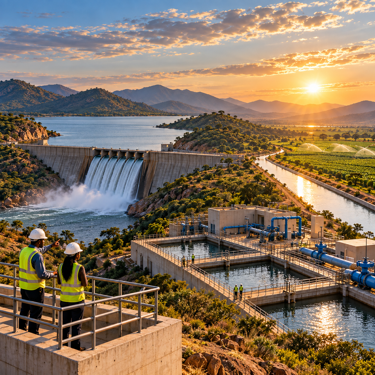
 AID Showcase