Present Africa's infrastructure projects to ministers, partners and investors. Open to every visitor, member and organisation that needs to brief stakeholders, with cinematic slides, map-led Atlas views and AI progress briefings.
647 published projects6 presentation themesAtlas map modeVoice narration
1Filter projectsby sector, country, stage or programme
2Selectthe projects you want to present
3Create a showwith AID Intelligence and present full screen
Establishment of a Navigational Line between Lake Victoria and the Mediterranean Sea - Feasibility Study Phase 2 (VICMED)T.IW.26.04
The VICMED initiative proposes an integrated navigation and multimodal transport corridor from Lake Victoria to the Mediterranean Sea. It is intended to connect Nile Basin countries through river, lake and…
TransportBurundi, Democratic Republic of Congo, Egypt, Ethiopia, Kenya, Rwanda, South Sudan, Sudan, Tanzania, UgandaCentral Africa, East Africa, North Africa, North-Eastern Africa2020
The Bedden Hydropower plant is a flagship initiative by the government of South Sudan. It is situated approximately 65km upstream from Juba. The scheme targets an installed capacity of around…
This project concerns the Sudan section of a high-voltage Ethiopia-Sudan power interconnection designed to move power from Ethiopia into Sudan and strengthen the Eastern Africa Power Pool. The existing database…
Integrated Watershed Management in Priority Catchments (Ribb, Gumera and Jema Watersheds)BIP_ENTRO_019
The Integrated Watershed Management in the Ribb, Gumera and Jema Watersheds project is one of the four fast track projects prepared in 2007 under the Eastern Nile Watershed Management (ENWM)…
Gogo Falls Water resources development (MPP)BIP_NELSAP_012
This Project is located in Western
Kenya. The dam is intended to provide flood controls,
irrigation development and hydropower generation. The project includes a 155
Mm3 dam, 20MW electricity, 30,000ha of irrigation,…
The Jita sub-basin measures 2,915 km2 in area, and is part of the Abbay (Blue Nile) River Basin located in the Central Ethiopian Highlands. The sub-basin partially covers five Woredas…
Borenga Dam and Mara Valley Multipurpose Water Resources Development ProjectBIP_NELSAP_011
The
Mara River Basin Project contributes to improved living conditions of the basin
communities by creating an enabling environment for sustainable
development-oriented investments and building capacity of riparian staff and
communities in integrated water…
Ruvyironza Multipurpose Water Resources Development ProjectBIP_NELSAP_017
The Ruvyironza Multipurpose Water Resources Development Project (PIDA Code: BIP_NELSAP_017) is a major infrastructure initiative in Burundi. The project's core component is the construction of a multipurpose dam on the…
The Uganda (Nkenda) - DR Congo (Beni-Butembo-Bunia-Mabuki) Power Transmission Inter-Connection Project is a strategic regional infrastructure initiative aimed at constructing a 400 kV double-circuit high voltage transmission line spanning 352.2…
EnergyDemocratic Republic of Congo, UgandaCentral Africa, East Africa2024-01-NRBIP
Construction of a transmission line that connects the power networks of Zambia, Tanzania and Kenya. This project includes the section of 905km Zambian section of the 2,800km ZTK interconnector from…
Nsongezi Hydroelectric Power StationBIP_NELSAP_007
The Nsongezi Hydropower Project is a proposed run-of-river scheme on the Kagera River, located along the border between Uganda and Tanzania. The project is also regionally relevant, with potential power…
Renk - Malakal Power Transmission LineBIP_NELSAP_022
The South Sudan (Renk) - South Sudan (Malakal) 220 kV High Voltage Power Transmission Interconnector project is located in the Upper Nile region, connecting the town of Renk in South…
Angololo Multipurpose Water Resources Development Project (Angololo Dam) NELSAPBIP_NELSAP_018
The Angololo Water Resources Development Project (AWDP) is located on the trans-boundary Malaba River that is between Kenya and Uganda and it falls within the Sio-Malaba Malakisi (SMM) River Basin…
ZTK Transmission Interconnector (Tanzania section -Mbeya to Tunduma) E.02.03.01
Construction of a transmission line that connects the power networks of Zambia, Tanzania and Kenya. This project includes the section of 400kV, 292km Iringa - Kisada - Mbeya transmission line,Â…
The Chemoga-Yeda sub-basin measures 2,738 km2 in area, and is part of the Abbay (Blue Nile) River Basin located in the Central Ethiopian Highlands. The sub-basin is located in Amhara…
Lake Victoria Water and Sanitation Initiative Phase II (LVWATSAN II)
This project involved construction
of water supply and sanitation systems, improving solid waste and storm water
management, improving watershed management, improving urban planning and
building capacity of urban authorities in 15 secondary towns…
WaterBurundi, Kenya, Rwanda, Tanzania, UgandaEast Africa
Kinyeti River Multi-purpose Water Resources Development ProjectBIP_ENTRO_009
Kinyeti River has its origins in the Imatong Mountains close to the South Sudan-Uganda border and from there flows northwards, eventually dispersing into the Badigeru swamp. The proposed project has…
Ethiopia (Gambela) - South Sudan (Malakal) Power Transmission Line - Phase 1BIP_NELSAP_021
The Ethiopia (Gambela) - South Sudan (Malakal) Power Transmission Line - Phase 1 project is located in the transboundary corridor connecting the Gambela region in southwestern Ethiopia to Malakal in…
EnergyEthiopia, South SudanNorth-Eastern Africa2024-01-NRBIP
The Kakono hydropower site is located on the Kagera River, Northwest Tanzania near the border with Uganda.
As a key component of Tanzania's energy strategy, Kakono offers a strategic opportunity…
Integrated Management of Transboundary Water Resources of Lakes Rweru, Cyohoha and the Akanyaru Marshlands (GIRET)BIP_NELSAP_001
The project area covers the Akanyaru marshland, the Lakes Cyohoha and Rweru and their watersheds shared by Rwanda and Burundi, and is located in the Akanyaru sub-basin and the downstream…
Limur / Nyimur multipurpose water resources projectBIP_NELSAP_016
The
Nyimur/Limur multipurpose water resources project is a transboundary project
located in the Aswa Basin covering parts of Lamwo District, Uganda and Magwi
Country, Eastern Equatorial State, South Sudan. The location coordinates are
3.560042°N,…
Dinger-Bereha Irrigation and Drainage ProjectBIP_ENTRO_002
Dinger Bereha Irrigation and Drainage Project is located in Chewaka Woreda develop a 7,500 ha irrigation scheme at Dinger Bereha in Chewaka Woreda. The project will abstract water from the…
Wad Meskin barrage across Rahad River has been planned to regulate the flood flows during rainy season, for Dinder and Rahad rivers so as to satisfy the needs of Rahad…
Taba-Gakomeye Multipurpose Water Resources Development ProjectBIP_NELSAP_020
The Taba-Gakomeye Multipurpose Water Resources Development Project is a planned infrastructure project in the Nile Equatorial Lakes Region, specifically in Burundi. Its primary purpose is to develop a multi-purpose reservoir…
Angololo Multipurpose Water Resources Transboundary Project
Angololo Water Resources
Development Project (AWDP) is located on the transboundary Malaba River shared
by Kenya and Uganda and falls within the Sio-Malaba Malakisi (SMM) River Basin
of the Nile Basin. The project…
The Ethiopia-Sudan Transmission Interconnection Project
The power system interconnection project involved the construction of a high voltage transmission line from Ethiopia to Sudan to utilise surplus hydropower from Ethiopia to replace oil-based thermal generation in…
The Kitale Town Sewerage Project aims to improve wastewater management and sanitation services in Kitale, Trans Nzoia County, addressing challenges from rapid urban growth. The project involves expanding and rehabilitating…
Atbara-Kerib Land Rehabilitation Project (Integrated Watershed Management in Priority Catchments (Atbara Watersheds))BIP_ENTRO_011
The Atbara Kerib Land Rehabilitation Project was one of 13 potential first-round investment projects identified in 2007 under the Cooperative Regional Assessment (CRA) of Watershed Management in the Eastern Nile…
The
Lau Watershed Management project is one of the four fast track projects
prepared in 2007 under the Eastern Nile Watershed Management (ENWM) Project. The
Lau Watershed project area is administratively located within…
Construction of a transmission line (580 km / 500 kV) that connects the power networks of Ethiopia and Sudan to facilitate trading in electricity and promote power systems stability. The…
Rehabilitation and Augmentation of Homabay Sewerage System and Last Mile ConnectivityBIP_LVBC_007
The project aims to address critical gaps in Homabay Town's sanitation infrastructure - protecting Lake Victoria from pollution and improve public health. The project focuses on both sewer rehabilitating the…
The
Kitoba-Lubango focal area (5,664 ha) is situated in is located between the
villages of Kitoba and Lubango, in the territory of Lubero, in the district of
Goma, in the province of North…
Majang Multipurpose Water Resources Development ProjectBIP_ENTRO_008
Majang development project is located in the Dunchaye kebele within the Godere woreda (Majang zone) Gambela Region, Ethiopia. The Majang Project, which will draw water from the Duchaye River, has…
Amala Norera Multipurpose Storage ReservoirBIP_NELSAP_010
The Amala-Norera WRD Project seeks to promote sustainable water management practices that balance the needs of various water users, including agriculture, livestock, and domestic use. The Project is part of…
Integrated Watershed Management in Dinder/Alitash national park sub-catchmentBIP_ENTRO_014
The Alatish-Dinder Transboundary Park Project was one of 13 potential first-round investment projects identified in 2007 under the Cooperative Regional Assessment (CRA) of Watershed Management in the Eastern Nile Basin.…
Integrated Watershed Management Project in Atbara CatchmentBIP_ENTRO_015
The Dinder, Atbara and Bau Watershed Management Project is one of the four fast track projects prepared in 2007 under the Eastern Nile Watershed Management (ENWM) Project. Three watersheds were…
Integrated Mukungwa wetland and landscape restoration projectBIP_LVBC_009
The Project aims to transform the Mukungwa Wetland into an urban wetland recreation and eco-tourism park with view to increase biodiversity, reduce flood risk and manage pollution. The project will…
Faecal Sludge and Solid Waste Management Project in Small Towns of Kyazanga and Kalangala IslandBIP_LVBC_005
The Faecal Sludge Solid Water Management project in the small towns of Kyazanga and Kalangala aims to establish sustainable, safe, and efficient faecal sludge management (FSM) systems to reduce illegal…
Transboundary Hydro-Meteorological and Environmental Monitoring System and Environmental Flows Assessment
Transboundary Hydro-Meteorological and Environmental Monitoring System and Environmental Flows Assessment Project is one of nine medium and long-term projecs identified and prioiritized under the Baro-Akobo-Sobat (BAS) Multipurpose Water Resources Study…
WaterEthiopia, South Sudan, SudanNorth-Eastern AfricaENTRO
Increase Muvumba's and Base's Community Resilience through Participatory and Ecosystem-based Catchment RestorationBIP_LVBC_008
The project aims to enhance climate and environmental resilience in the Muvumba and Base river catchments, covering communities in Nyagatare, Rulindo, Gakenke, and Burera districts. It targets 40,000 direct beneficiaries…
Construction of Trunk Sewer and Industrial Wastewater Treatment Plant (WWTP) at Nyakato Area.
The industrial WWTP is estimated to treat 7,500m3/day which will treat total amount of waste water produced from the existing Industries. The system is proposed to have anaerobic ponds followed…
Telkuk Water Harvesting Project Telkuk Water
Harvesting Project is to promote the sustainable management of rangeland in the
Talkuk Locality, Kassala State. Proposed project interventions include:
Increasing
water harvesting through constructing traditional teras, libish,…
Akobo-Gambella Floodplains Transboundary Development ProgrammeBIP_ENTRO_007
The Akobo-Gambella floodplains transboundary development programme is one of the three short term projects proposed as part of the Baro-Akobo-Sobat multipurpose water resources development study project. The three short term…
WaterEthiopia, South Sudan, SudanNorth-Eastern AfricaENTRO
The Sudd wetland is one of the most unique and valuable ecosystems on Earth. It is the largest wetland in Africa, and a designated a Ramsar site. The Sudd wetlands…
WaterEgypt, Ethiopia, Kenya, South Sudan, Sudan, UgandaEast Africa, North Africa, North-Eastern AfricaENTRO
Construction for Faecal Sludge Treatment Plant in Muhanga TownBIP_LVBC_004
The construction of the Faecal Sludge Treatment Plant (FSTP) in Muhanga Town is designed to address the growing need for effective and sustainable faecal sludge management by providing a dedicated…
TransportT.IW.26.04Establishment of a Navigational Line between Lake Victoria and the Mediterranean Sea - Feasibility Study Phase 2 (VICMED)
Burundi, Democratic Republic of Congo, Egypt, Ethiopia, Kenya, Rwanda, South Sudan, Sudan, Tanzania, UgandaCentral Africa, East Africa, North Africa, North-Eastern Africa2020
The VICMED initiative proposes an integrated navigation and multimodal transport corridor from Lake Victoria to the Mediterranean Sea. It is intended to connect Nile Basin countries through river, lake and supporting land-transport infrastructure and to improve access for landlocked countries to international ports and markets.
The project's expected benefits include lower-cost movement of goods, improved regional trade and tourism, employment creation and stronger economic integration. It also requires careful assessment of water-resource, environmental, social, navigational and institutional implications across a large transboundary basin.
The prefeasibility study, which involved consultation with the footprint countries, was completed in 2015 and approved in 2017 by the 3rd Steering Committee for VICMED.
The feasibility study Phase 1 was completed in July 2019 and was funded through a US$650,000 grant from AfDB. It involved the development of an institutional and legal framework for VICMED and conducting a training needs assessment. It also involved preparing the terms of reference for Feasibility Study Phase 2 and carrying out training for countries on inland water transport, which took place in February.
The Bedden Hydropower plant is a flagship initiative by the government of South Sudan. It is situated approximately 65km upstream from Juba. The scheme targets an installed capacity of around 540 - 570 MW.
First mapped out in detailed energy-sector roadmaps from around 2009, Bedden was identified as a key long-term priority alongside other major hydropower sites on the Bahr El Jebel such as Fula, Lakki, and Shukoli.
The project underwent feasibility and environmental impact assessments, and a conceptual EPC (Engineering, Procurement, and Construction) was prepared in 2013.
The plant design envisions a 32m high concrete gravity dam reaching a height of roughly 65m with a reservoir crest length of around 5km and an effective hydraulic head of approximately 30m. Once operational, it would substantially alleviate grid constraints in and around Juba and possibly feed power into the broader national grid and regional interconnections.
Democratic Republic of Congo, UgandaCentral Africa, East Africa
The Semliki River is part of the Nile River Basin with two thirds of
its course being in the DRC and the lower third forming the boundary between
the DRC and Uganda. Great Lakes Region is characterized by a shortage of
indigenous energy sources and highly skewed relationships of dependency
regarding energy imports Less than 10% of the population has access to
electricity. The region is thus heavily dependent on oil imports Currently,
majority of the population of Eastern DRC, Rwanda, Burundi and Uganda relies on
bio-fuels such as wood The power demand for the cities of Beni, Butembo and
surroundings will be supplied from a hydropower station on the Semliki River
with a capacity of 72 MW. It will need a step-up transformer MV/HV or MV;
including the construction of the distribution network. The Semliki hydropower
station would serve mainly the towns of Béni and Butembo as well as the rural
areas located around these towns. The available reserve could be exported to
the Great Lakes Region with an interconnection grid. The Semliki is one of four (the others are Mogomba, Muyama and Kiyimbi) proposed hydropower projects, packaged to have potential capacity of 150MW, generating annual energy production of 800 GWh.
A hydropower
station on the Semuliki River of 72 MW; - power distribution network low and high voltage in the
towns of Beni and Butembo and surroundings. The distribution network is
envisaged to be a Medium Voltage network. Béni and Butembo will be served by 30
kV lines from the substation at the Semliki plant.
Butembo has
already a network LV and MV linked to its own hydropower station. However its
network will be adapted to the parameters of the Semliki project (distribution
voltage 30 kV, distribution 6.6 kV) and will in some cases be extended. A high
voltage transmission line (220kV) from Goma - Butembo - Béni whose feasibility
is complete will also be constructed to evacuate the generation from Semuliki.Dated studies suggested the project would cost USD 900m. Several areas that require particular attention have been noted in previous studies including: Improvement of hydrological data and modelling, economic modelling to determine viability, comprehensive ESIA to address potentially large environmental challenges, the actual geological conditions, layouts and designs.
A budget of USD 6m has been included in the phase of the NEL-IP for the required studies to define the project better.
This project concerns the Sudan section of a high-voltage Ethiopia-Sudan power interconnection designed to move power from Ethiopia into Sudan and strengthen the Eastern Africa Power Pool. The existing database record describes a 500 kV transmission line ending near Khartoum, with new or upgraded high-voltage substation facilities at Rabak and Jebel Aulia in Sudan and bay extensions linked to the Grand Ethiopian Renaissance area and Sudanese network nodes.The project has an important history. Ethiopia and Sudan already implemented an earlier interconnector, which the Nile Basin Initiative documents as commissioned around 2010-2013 and used to support regional power trade. That earlier success provides a technical and institutional basis for the larger 500 kV scheme, but it does not by itself validate the very high CAPEX currently stored against this record.Validation note: external sources confirm the strategic rationale and earlier Ethiopia-Sudan interconnection history, but I did not find a reliable external source confirming the current capex_cost value of 48,494 in USD million. The financial fields should therefore remain under owner validation before being used in investment material.Sources reviewed: World Bank, Regional Eastern Nile - Ethiopia-Sudan Power System Interconnector Project, https://documents.worldbank.org/en/publication/documents-reports/documentdetail/935901468201843498; Nile Basin Initiative, Ethiopia-Sudan interconnection success story, https://nilebasin.org/sites/default/files/2023-09/Ethiopia-Sudan%2520interconnection%2520success%2520story.pdf.
WaterBIP_ENTRO_019Integrated Watershed Management in Priority Catchments (Ribb, Gumera and Jema Watersheds)
EthiopiaNorth-Eastern AfricaENTRO
The Integrated Watershed Management in the Ribb, Gumera and Jema Watersheds project is one of the four fast track projects prepared in 2007 under the Eastern Nile Watershed Management (ENWM) Project. The project was prepared as an integral part of Tana-Beles Watershed Management Project. The project area was comprised of five micro-watersheds/development clusters totaling 80,600 ha in area and split roughly equally between the Ribb, Gumera and Jema watersheds, each of which drains into Lake Tana.
The project objective was to improve the livelihoods of rural households living in the upper catchments of Ribb, Gumera and Jema Watersheds in Ethiopia through enhanced productivity and promotion of sustainable land use practices. The project was structured along three mutually supportive themes, namely (a) theme A on livelihoods, which had four components directed at improving livelihoods through better communications, increased productivity and enhanced income generation; (b) theme B on natural resources, which had two main components covering soil and water management and forestry and agro-forestry measures aimed at creating a sustainable landscape that limits erosion and creates a more productive basis for livelihood generation; and (c) theme C on capacity building and project management that addresses the immediate constraints in capacity to implement the project and sustain the outcomes through more robust community and government institutions.
Specific interventions under the project included upgrading rural feeder roads; establishing micro-finance schemes; improving water supply and sanitation systems; improving facilities at health posts and primary schools; demonstration of improved cropping practices (such as alley cropping, intercropping, strip cropping, cover cropping, etc), improved seed and fertilizer use; integrated pest management; controlled ploughing; stabilization of terraces and gullies with trees and shrubs; cultivation of pasture grasses and leguminous hedgerows for fodder production; establishment of animal health posts; development of dairy processing and animal fattening programmes; classification of land base on slope and introduction of appropriate soil and water conservation measures such as land closure, bench terracing, stone bunds, earth bunds, contour bunds and check dams; promotion of rainwater harvesting; promotion of small scale irrigation; establishment of tree nurseries and planting of private and community woodlots.
WaterBIP_NELSAP_012Gogo Falls Water resources development (MPP)
KenyaEast Africa
This Project is located in Western
Kenya. The dam is intended to provide flood controls,
irrigation development and hydropower generation. The project includes a 155
Mm3 dam, 20MW electricity, 30,000ha of irrigation, up to 86,400m3 /d water
supply, benefitting 1.152m people. Detailed feasibility and design studies have
been done for this project and it now requires implementation, estimated at USD
393.7m over 3 years, which has been included in NEL-IP.
The Jita sub-basin measures 2,915 km2 in area, and is part of the Abbay (Blue Nile) River Basin located in the Central Ethiopian Highlands. The sub-basin partially covers five Woredas in the South Gonder and North Wollo Zones of Amhara Regional State. The sub-basin is characterized by high elevations (2,500 â€" 3000 m amsl in most parts; down to 1,200 m in the lowest part), steep slopes, high rainfall intensity that generates considerable runoff, intensive cultivation, overgrazing and deforestation. These characteristics, and the use of inefficient traditional farming methods and growing human population on naturel resources lead to soil erosion, soil fertility decline, water scarcity and deepening poverty.
The objectives of the Jita project are fourfold, to: (a) improve natural resources management through sustainable land management practices; (b) improve agricultural productivity by introducing improved crop and livestock technologies; (c) enhance Institutional capacity through various capacity building activities; and (d) diversify the livelihoods of local communities with a focus on women and youth by introducing different off-farm activities. The project as three components on sustainable land management, livelihoods support, and institution capacity building.
The project was identified in 2007 under the Cooperative Regional Assessment (CRA) of the Eastern Nile Watershed Management Project (ENWM), which was itself part of the Integrated Development of the Eastern Nile. Full feasibility and project preparation studies were completed in 2012 under the Project Delineation and Prioritization study supported under the NBI Institutional Strengthening Project (ISP). Both phases of the studies were funded by the Nile Basin Trust Fund.Â
WaterBIP_NELSAP_011Borenga Dam and Mara Valley Multipurpose Water Resources Development Project
TanzaniaEast Africa
The
Mara River Basin Project contributes to improved living conditions of the basin
communities by creating an enabling environment for sustainable
development-oriented investments and building capacity of riparian staff and
communities in integrated water resources management and development. The
project is preparing several investment proposals in the fields of water
infrastructure, watershed management and irrigation infrastructure for
subsequent funding within a consistent basin development strategy. This
primarily irrigation project includes the Borenga Dam, will benefit 100,000
people, irrigate 8,340Ha in 13 villages of Serengeti and Butiama Districts,
2.85MW hydropower, water supply to 18 villages in Serengeti, Butiama and Tarime
Districts in Tanzania.
WaterBIP_NELSAP_017Ruvyironza Multipurpose Water Resources Development Project
BurundiEast Africa2024-01-NRBIP
The Ruvyironza Multipurpose Water Resources Development Project (PIDA Code: BIP_NELSAP_017) is a major infrastructure initiative in Burundi. The project's core component is the construction of a multipurpose dam on the Ruvyironza River, a tributary of the Kagera River. The primary purposes are irrigation, hydropower generation, and water supply. The dam is expected to create a reservoir with a surface area of approximately 11 square kilometers, inundating about 11 km of the Gitega-Ngozi highway, the Kibaya Bridge, and the Kibaya river gauge. The project scope includes: 1) Development of 14,674 hectares of irrigated agriculture across five provinces (Cankuzo, Gitega, Karuzi, Muyinga, Ruyigi); 2) Installation of a 22 MW hydropower plant; 3) Provision of water for municipal and livestock supply, and aquaculture; 4) Catchment restoration activities upstream of the dam (covering a 1,999 km2 area) to address land degradation. The project preparation phase, managed by the Nile Equatorial Lakes Subsidiary Action Program (NELSAP), includes comprehensive feasibility studies, detailed design, Environmental and Social Impact Assessment (ESIA), Resettlement Action Plan (RAP), and tender document preparation.
WaterBIP_NELSAP_015Ngono MPP Water Resources Development Project (MPP)
TanzaniaEast Africa
The Ngono Valley project
(located in the western shores of Lake Victoria and shared by the Districts
of Bukoba Rural and Missenyi) will develop a multipurpose reservoir, net
irrigated agriculture of approximately 5,825 ha, generation of hydropower, as
well as contribute towards sustainable land management of endangered
sub-catchments in the Ngono River Basin. The proposed projects are part of
the investment projects advanced by Tanzania to the NELSAP for projects
preparation and which were prioritized through the NEL Multi-Sector
Investment Opportunity Analysis. The project has been phased into two stages
as follows: The project includes command areas and a canal for small scale
farmers (stage 1), followed by stage 2 which includes a 17m high, 268 MCM
Dam, Hydropower plant with installed capacity 1.65MW, mean annual energy
production 8.7GWh, irrigation command areas for small- and large-scale
farming and will have 100,000 beneficiaries including water supply to 23
villages in Missenyi and Bukoba Districts on the western shores of Lake
Victoria, Tanzania. Feasibility studies, detailed design, ESIA have been
done, and the project is now seeking implementation funding of USD 243m.
Democratic Republic of Congo, UgandaCentral Africa, East Africa2024-01-NRBIP
The Uganda (Nkenda) - DR Congo (Beni-Butembo-Bunia-Mabuki) Power Transmission Inter-Connection Project is a strategic regional infrastructure initiative aimed at constructing a 400 kV double-circuit high voltage transmission line spanning 352.2 km, linking Nkenda substation in Kasese, Western Uganda, to new substations at Beni, Butembo, Bunia and Mabuki in the North Eastern region of the Democratic Republic of Congo (DRC).
The project includes upgrading the Nkenda substation and aims to integrate the isolated and eastern DRC power grid with Uganda's national grid, thereby enhancing electricity reliability, security, and access in the region.
It supports optimal utilization of generation resources, promotes regional power trade, and facilitates least-cost power expansion projects, contributing to socio-economic development and environmental sustainability.
Sponsored by the Nile Basin Initiative/Nile Equatorial Lakes Subsidiary Action Program (NBI/NELSAP), Uganda Electricity Transmission Company Limited (UETCL), and Société Nationale d'Électricité (SNEL), the project is aligned with the East African Power Pool (EAPP) Master Plan to create a regional power highway which aims to maximise the affordable availability of electricity around the region. Increasing power trade is key to this aspiration.
Construction of a transmission line that connects the power networks of Zambia, Tanzania and Kenya. This project includes the section of 905km Zambian section of the 2,800km ZTK interconnector from Kabwe-Pensulo-Nakonde-Kasama in Zambia to Tunduma in Tanzania. The project was envisioned to be implemented in two phases starting with the Kabwe-Pensulo-Kasama-Nakonde section and the second phase would have comprised the Kabwe-Pensulo-Mpika-Kasama section. It will have had a capacity of 500MW, upgradable to 2000MW depending on power demand.
The original concept for the ZTK Interconnector was a high voltage 330 kV transmission line going from Pensulo (Zambia) to Nairobi (Kenya) with three connection points in Tanzania (Mbeya, Singida and Arusha). At that time, Tanzania grid was operated at 220 kV. The original concept of the ZTK Interconnector has been replaced, by two interconnections between two national grids: the Kenya-Tanzania Interconnection and the Zambia-Tanzania Interconnection.
EnergyBIP_NELSAP_007Nsongezi Hydroelectric Power Station
Rwanda, Tanzania, UgandaEast Africa2024-01-NRBIP
The Nsongezi Hydropower Project is a proposed run-of-river scheme on the Kagera River, located along the border between Uganda and Tanzania. The project is also regionally relevant, with potential power supply benefits to Rwanda.
Although the project features a 20m high concrete dam on the Kagera River, reservoir storage and operation is such that the scheme effectively operates as a run-of-river scheme. The main role of the reservoir is to balance energy production gains with minimized environmental and social impacts.
The hydropower plant will consist of an open-air powerhouse on the Ugandan side of the river, equipped with three vertical Kaplan turbines. Positioned downstream of the Kikagati Power Station, Nsongezi aims to fully utilize the hydropower potential of this 25 km stretch of the Kagera River. Turbine discharge is expected to be in the range of 220-250 m³/s, Power evacuation will be via a 35 km, 132 kV transmission line connecting the plant to Uganda's Mirama Hills substation.
The project is included in Uganda's Second National Development Plan (NDPII) for the 2015/16 - 2019/20 period. It is also included in NELSAP's Investment Strategy Action Plan (2012).
EnergyBIP_NELSAP_022Renk - Malakal Power Transmission Line
South Sudan, SudanNorth-Eastern Africa2024-01-NRBIP
The South Sudan (Renk) - South Sudan (Malakal) 220 kV High Voltage Power Transmission Interconnector project is located in the Upper Nile region, connecting the town of Renk in South Sudan border with Sudan to Malakal in South Sudan.
The South Sudan (Renk) - South Sudan (Malakal) 220 kV High Voltage Power Transmission Interconnector project involves the construction of a 220 kV transmission line approximately 320 km long, connecting the town of Renk in Sudan to Malakal in South Sudan.
This interconnection aims to facilitate the import of up to 140 MW of electricity from Sudan to South Sudan, addressing the latter's critical power supply shortages and enhancing regional energy security.
The project includes the development of associated substations and distribution infrastructure in South Sudan's Upper Nile State to improve electricity access and reliability for local communities. It forms part of the Nile Basin Initiative's efforts to promote regional power trade and integration within the Eastern Africa Power Pool framework, supporting socio-economic development and stability in the border regions.
WaterBIP_NELSAP_018Angololo Multipurpose Water Resources Development Project (Angololo Dam) NELSAP
Kenya, UgandaEast AfricaIGAD
The Angololo Water Resources Development Project (AWDP) is located on the trans-boundary Malaba River that is between Kenya and Uganda and it falls within the Sio-Malaba Malakisi (SMM) River Basin within the Lake Victoria sub basin. The Angololo project was identified by Kenya and Uganda in collaboration with Nile Equatorial Lakes Subsidiary Action Program (NELSAP) through its Sio Malaba Malakisi (SMM) River Basin Management (RBM) project. NELSAP-CU conducted its prefeasibility studies in 2010 with grant financing from the Royal Government of Sweden and the Royal Government of Norway. Following this identification study, the Governments of Kenya and Uganda formally requested NELSAP to integrate it into its pipeline of natural resources projects for further appraising and development. The project was approved during the 18th Nile Equatorial Lakes Council of Ministers (NELCOM) meeting held in Entebbe, Uganda on 13th October 2015 and was included into the African Development Bank (AfDB) pipeline (IOP) for the year 2016 – 18 to seek possible funding support. NELSAPCU/NBI was mandated in the signed MOU between Uganda and Kenya to support in mobilization of resources for preparation of the investment project. NELSAPCU approached AfDB Eastern Africa Regional Centre (EARC) for funding to undertake preparation studies. The project studies will consist of the following components: • Feasibility Study, Detailed Design and Preparation of Tender Documents; • Independent Environmental and Social Impact Assessment (ESIA) and Resettlement Action Plan (RAP) • Stakeholder engagements to validate project study outputs. Once proven economically viable, the project studies will proceed to Detailed Designs (DD), and preparation of tender documents.
Construction of a transmission line that connects the power networks of Zambia, Tanzania and Kenya. This project includes the section of 400kV, 292km Iringa - Kisada - Mbeya transmission line, 122km of 400kV Mbeya - Tunduma transmission line and 4km of 400kV transmission line from Tunduma to Border of Zambia.Â
The Chemoga-Yeda sub-basin measures 2,738 km2 in area, and is part of the Abbay (Blue Nile) River Basin located in the Central Ethiopian Highlands. The sub-basin is located in Amhara Regional State, East Gojam Regional office. The sub-basin is characterized by high elevations (2000 â€" 3900 m amsl in most parts, down to 890 m in the lowest part), steep slopes, high rainfall intensity that generates considerable runoff, intensive cultivation, overgrazing and deforestation. These characteristics, and the use of inefficient traditional farming methods and growing human population lead to soil erosion, soil fertility decline, water scarcity and deepening poverty.
The objectives of the Chemoga-Yeda project are fourfold, to: (a) improve natural resources management through sustainable land management practices; (b) improve agricultural productivity by introducing improved crop and livestock technologies; (c) enhance Institutional capacity through various capacity building activities; and (d) diversify the livelihoods of local communities with a focus on women and youth by introducing different off-farm activities. The project as three components on sustainable land management, livelihoods support, and institution capacity building.
The project was identified in 2007 under the Cooperative Regional Assessment (CRA) of the Eastern Nile Watershed Management Project (ENWM), which was itself part of the Integrated Development of the Eastern Nile. Full feasibility and project preparation studies were completed in 2012 under the Project Delineation and Prioritization study supported under the NBI Institutional Strengthening Project (ISP). Both phases of the studies were funded by the Nile Basin Trust Fund.Â
WaterLake Victoria Water and Sanitation Initiative Phase II (LVWATSAN II)
Burundi, Kenya, Rwanda, Tanzania, UgandaEast Africa
This project involved construction
of water supply and sanitation systems, improving solid waste and storm water
management, improving watershed management, improving urban planning and
building capacity of urban authorities in 15 secondary towns in the Lake
Victoria Basin. This project intends to meet the Millennium
Development Goals and support secondary urban centers in the Lake Victoria
Basins to contribute to the reversal of the pollution of the lake through
improvements of sustainable water supply and sanitation infrastructure in 15
secondary towns within the Lake Victoria Basin.
The selected towns were across East Africa
countries with Burundi having 3 towns that included: Ngozi, Muyinga and
Kayanza. In Kenya, Keroka, Kericho and Isebania were among the towns while in
Rwanda, Kayonza, Nyagatare and Nyanza were identified. Tnazania had Geita,
Sengerema and Nansio towns added while Uganda had Mayuge, Buwama-Kayabwe-Bukakata
and Ntungamo. The implementation was launched in 2011 with approx. 110 MUSD
grant funding from the African Water Facility. This component of LVWATSAN was
called LVWATSAN Phase II. Africa Development Bank entered into a Contribution
Agreement with UN-HABITAT to offer Technical Assistance and Capacity Building
Programme. MWAUWASA was delegated to take the role of implementing authority
for the 3 Tanzanian towns; Geita, Sengerema and Nansio, financed by AfDB.
The water supply has been improved for 784,470 residents of beneficiary towns
across the Partner States.
WaterBIP_ENTRO_009Kinyeti River Multi-purpose Water Resources Development Project
South SudanNorth-Eastern AfricaENTRO
Kinyeti River has its origins in the Imatong Mountains close to the South Sudan-Uganda border and from there flows northwards, eventually dispersing into the Badigeru swamp. The proposed project has multiple components including small scale potable water supplies, fisheries management, irrigation, livestock watering and watershed management.
The Kinyeti River multipurpose development project is one of the three short term projects proposed as part of the Baro-Akobo-Sobat multipurpose water resources development study project. The three short term projects are based on the sustainable development of water resources. They aim at providing inter-sectoral benefits and improving people’s livelihoods in the sub-basin. The Kinyeti project is centered around the construction of a multipurpose dam in Eastern Equatoria, South Sudan, upstream of the city of Torit.
The project has been designed to provide the following benefits:
The 45 million m3 reservoir will secure water access for the city of Torit (100,000 inhabitants projected in 2041). It will also support capture fisheries and recreational activities
The regulation of the flow will provide water for the development of irrigation (1,000 ha) and aquaculture (100 ponds of 200 m²) downstream of the dam. It will also provide water for the livestock all year round and satisfy an environmental flow during the dry season. Irrigation and aquaculture will be introduced in this area and there would be room for further expansion of these activities in the future.
A Feasibility studies completed with an estimated investment costs is USD 92 million
EnergyBIP_NELSAP_021Ethiopia (Gambela) - South Sudan (Malakal) Power Transmission Line - Phase 1
Ethiopia, South SudanNorth-Eastern Africa2024-01-NRBIP
The Ethiopia (Gambela) - South Sudan (Malakal) Power Transmission Line - Phase 1 project is located in the transboundary corridor connecting the Gambela region in southwestern Ethiopia to Malakal in South Sudan. It involves constructing a 357 km, 220400 kV transmission line connecting the Gambela region in Ethiopia to Malakal in South Sudan.
This interconnection aims to facilitate the export of 100800 MW of electricity from Ethiopia to South Sudan initially, with plans to gradually increase power imports up to 4001000 MW, thereby addressing South Sudan's critical electricity demand while generating revenue for Ethiopia.
The project includes conducting feasibility studies, environmental and social impact assessments, and resettlement action plans, with construction expected to commence within two years following study completion. It is part of a broader regional effort to enhance electricity trade, grid integration, and energy security between the two countries, supported by a joint technical committee to oversee implementation and future expansions, including a planned 700-kilometer line from Ethiopia's Tepi distribution centre to Juba, South Sudan's capital.
The Kakono hydropower site is located on the Kagera River, Northwest Tanzania near the border with Uganda.
As a key component of Tanzania's energy strategy, Kakono offers a strategic opportunity for expanding renewable energy, enhancing grid stability, and reducing dependency on fossil fuels. This run-of-river site, downstream among the potential locations on the Kagera River, aligns with national development goals.
The Project will entail the construction of a concrete-faced rockfill dam (42 m high and 1,380 m long) and a gravity roller-compacted concrete dam (61 m high and 284 m long) producing a hydropower potential exploited through a powerhouse at the toe of the dam.
The limited live reservoir storage volume of 90 Mm3 will allow the option of daily regulation of the river flow when necessary. The power plant will comprise two Kaplan turbines, each with a capacity of 43.9MW and a maximum combined discharge of is 3,16m3/s.
The project will also include a 38.5 km long 220 kV transmission line to the existing substation at Kyaka and will be managed by Tanzania Electric Supply Company Limited (TANESCO).
Preparations are well advanced and include a detailed Environmental and Social Impact Assessment (ESIA), completed in 2022.
WaterBIP_NELSAP_001Integrated Management of Transboundary Water Resources of Lakes Rweru, Cyohoha and the Akanyaru Marshlands (GIRET)
Burundi, RwandaEast Africa
The project area covers the Akanyaru marshland, the Lakes Cyohoha and Rweru and their watersheds shared by Rwanda and Burundi, and is located in the Akanyaru sub-basin and the downstream Nyabarongo sub-basin, both being part of the Kagera sub-basin shared by Rwanda, Burundi, Uganda and Tanzania. The project area has experienced a steady decline in the level of ecosystem services from being the food basket of Rwanda and Burundi in the 1960s with widespread forest area and plenty of rainfall to its current status of frequent drought, soil erosion and lack of grazing land.Â
The objective of this project is to enhance:
Co-ordination, sustainable development, management and utilization of the Lakes Cyohoha, Rweru, Akanyaru marshland environment, including water and fisheries resources production
Contribute to poverty reduction and the reversal of environmental degradation in the Bugesera region shared by Rwanda and Burundi, especially in the Rweru and Cyohoha lakes basins and Akanyaru marshland.
The project aims to develop 4,200ha irrigated land; 2.5 million agroforestry trees; 765ha riverbank & lake shores protected; restocking of 2 lakes; support to 9 fishermen cooperatives; 1 million beneficiaries including 4,500 fisher folks and improved capacity of more than 6,500 farmers.Â
In more detail:
Integrated Agriculture and Watershed Development and Management: Nearly 2,000 ha of irrigated land set up with hillside irrigation techniques and effective marshland management, more than 6,500 farmers with improved capacities on improved seeds, dairy cows and post-harvest infrastructures
Watershed management: Mechanisms and capacities for joint water monitoring and management in place and operational, Protection of 765 ha of lakeshores and Akanyaru riverbanks with fodder grass, agroforestry, fruit, bamboo and indigenous tree species. Conservation of aquatic ecosystems and biodiversity through restoration of lakes shores, spawning sites and catchments and joint mechanisms for fishery and water resources monitoring and management
Fisheries Resources Development and Management: Restock of the 2 lakes with 1,000,000 tilapia fingerlings, support construction of fishery infrastructures and strengthen capacities of 9 fishermen cooperatives and key stakeholders for sustainable fishery development. Regional Integration and peace building through harmonized policies frameworks
Capacity building and development: Capacity building for alternative livelihood and by commodity chain of 4,500 beneficiaries from fishery, farmers and agriculture cooperatives, 50% being women. Leading to poverty reduction and improved food security. This component also specifically addresses knowledge generation and dissemination systems to monitor specific risks and threats, notable climate change and variability.
The project is ready for implementation and requires funding of USD 95m over 4 years implementation to enable the project to become financially self-sufficient.
WaterBIP_NELSAP_016Limur / Nyimur multipurpose water resources project
South Sudan, UgandaEast Africa, North-Eastern Africa2024-01-NRBIP
The
Nyimur/Limur multipurpose water resources project is a transboundary project
located in the Aswa Basin covering parts of Lamwo District, Uganda and Magwi
Country, Eastern Equatorial State, South Sudan. The location coordinates are
3.560042°N, 32.361010°E. The project comprises of several components, including
a community-based irrigation scheme, a dam and water reservoir, a water and
soil conservation component and flood control component. The core scheme of the
project consists of a 26 m head dam on the Nyimur River, a mini hydropower
plant with a 350 kW capacity; and development of 5,105 ha for paddy rice
irrigation. The project is expected to benefit 12,000 people from the two
countries.
The
preparatory studies (2015-2019) included feasibility studies for community-based
irrigation, hydropower generation, and watershed management; an Environmental
and Social Impact Assessment (ESIA); and preparation of a Resettlement Action
Plan (RAP). At the project end in 2019, a roundtable donors meeting was held to
mobilize resources for the implementation phase.
Project
preparation activities were funded through a EUR 1.975 million grant from the
AfDB, with EUR 0.587 million co-funding from NELSAP-CU and EUR 34,608 in
in-kind support from the countries.
WaterBIP_ENTRO_002Dinger-Bereha Irrigation and Drainage Project
EthiopiaNorth-Eastern Africa2024-01-NRBIP
Dinger Bereha Irrigation and Drainage Project is located in Chewaka Woreda develop a 7,500 ha irrigation scheme at Dinger Bereha in Chewaka Woreda. The project will abstract water from the Didessa River and comprises of a mass concrete weir headworks, a 15 km main canal, primary canals and tertiary distribution system of HDPE pipes.
The project feasibility studies were completed in 2010. with funding from the African Development Fund.
Wad Meskin barrage across Rahad River has been planned to regulate the flood flows during rainy season, for Dinder and Rahad rivers so as to satisfy the needs of Rahad Project Phase I, through Abu Rakham barrage as a downstream regulator, and to divert water to Rahad Project Phase II for summer crops through a main canal. This same barrage would regulate water transported from the Roseires Dam, after the heightening project completion, with the link canal through Dinder River barrage to the project.
It lies between Hawata town and Wad Meskin on the eastern side of the seasonal Rahad river. The defunct railway line from Khartoum to Gadarif then Port Sudan crosses the Rahad river at Hawata which lies on the northern end of the project. The Wad Meskin Project site is close to the Rahad Project Phase II.The project area is located on the eastern bank of Rahad River and its land is shared between Gezira and Gadarif States.
The 53.8 km long open earth canal linking the two barrages at Salsal and Wad Meskin on Dinder and Rahad Rivers respectively. Its function is to convey part of Dinder waters to Rahad.
WaterBIP_NELSAP_020Taba-Gakomeye Multipurpose Water Resources Development Project
RwandaEast Africa2024-01-NRBIP
The Taba-Gakomeye Multipurpose Water Resources Development Project is a planned infrastructure project in the Nile Equatorial Lakes Region, specifically in Burundi. Its primary purpose is to develop a multi-purpose reservoir on the Ruvyironza River to address water scarcity, enhance food security, and support socio-economic development. The project scope includes the construction of a dam and reservoir for irrigation, domestic water supply, livestock watering, and potentially hydropower generation. It is designed to regulate river flow, mitigate floods, and improve water availability for surrounding communities and agricultural activities. The project is part of the broader Nile Equatorial Lakes Subsidiary Action Program (NELSAP) under the Nile Basin Initiative.
WaterAngololo Multipurpose Water Resources Transboundary Project
Kenya, UgandaEast Africa
Angololo Water Resources
Development Project (AWDP) is located on the transboundary Malaba River shared
by Kenya and Uganda and falls within the Sio-Malaba Malakisi (SMM) River Basin
of the Nile Basin. The project consists of a proposed 30 m high dam with a
reservoir capacity of 43.0 MCM and hydropower generation capacity of 1.75 MW.
The dam will supply potable water to 20,000 people and irrigate 3,300 hectares
(1,180 ha in Kenya and 2,120 ha in Uganda). The project also includes
rehabilitation of the 430 km2 watershed upstream of the dam. In
total the Angololo Water Resources Development Project is expected to benefit
at least 127,300 people from Tororo, Manafwa, and Namisindwa districts in
Eastern Uganda and Busia and Bungoma Counties in Kenya through employment
creation, irrigated agriculture, piped water supply, hydropower generation, and
livestock and fisheries production.
The Angololo project was
identified by Kenya and Uganda in collaboration with NELSAP-CU under the Sio
Malaba Malakisi (SMM) River Basin Management (RBM) project. NELSAP-CU conducted
its prefeasibility studies in 2010 with grant financing from the Royal
Government of Sweden and the Royal Government of Norway. Feasibility studies
(including detailed designs, ESIA and RAP studies and stakeholder engagement)
commenced in 2019 with a US$ 1.5 million grant from NEPAD-IPPF and are expected
to reach completion in 2021.
The project is located at
coordinates 0.693243°N, 34.306400°E
The power system interconnection project involved the construction of a high voltage transmission line from Ethiopia to Sudan to utilise surplus hydropower from Ethiopia to replace oil-based thermal generation in Sudan. The interconnection was also intended to allow for pooling of reserves in emergency situations, which would allow electricity to be transferred from Sudan to Ethiopia during times of severe hydrological conditions in Ethiopia. The interconnection will also achieve considerable savings in the operation of power plants in the long run.
The Ethiopia-Sudan Transmission Interconnection Project comprised of a new 194 km double circuit 230/220 KV transmission line linking Shehedi in Ethiopia to Gedaref in Sudan; reinforcement of Ethiopia’s existing 260 km single circuit line linking Bahir Dar to Gonder and Shehedi; and a new 36.5 km high voltage, double circuit, 230/220 kV, three phase alternating current transmission line linking Shehedi to Metema at the Ethiopia-Sudan border. The transmission capacity of the power lines is 100 MW.
The construction phase of the project was nationally funded and implemented between 2009 and 2013.
The Kitale Town Sewerage Project aims to improve wastewater management and sanitation services in Kitale, Trans Nzoia County, addressing challenges from rapid urban growth. The project involves expanding and rehabilitating the sewer network through construction of 94 Km of Trunk and Secondary Sewers including 5,000 plot connections to increase household connections. Two new wastewater treatment plants-the Rafiki WWTP (4,600 m³/day capacity) and the Sirende WWTP(5,600 m³/day capacity)-will be constructed to ensure efficient, environmentally friendly treatment of sewage, replacing the existing Machinjoni and Bidii plants. A total of 85,779 inhabitants will benefit from the project.
The project also includes upgrading sewer lines, decommissioning obsolete infrastructure, and strengthening the capacity of local operators. Environmental and social safeguards are integrated to minimize impacts and promote community engagement. Upon completion, the project will significantly reduce pollution, protect local water bodies, and enhance public health and living standards, supporting Kitale's sustainable urban development and setting a benchmark for effective wastewater management in Kenya.
WaterBIP_ENTRO_011Atbara-Kerib Land Rehabilitation Project (Integrated Watershed Management in Priority Catchments (Atbara Watersheds))
SudanNorth-Eastern AfricaENTRO
The Atbara Kerib Land Rehabilitation Project was one of 13 potential first-round investment projects identified in 2007 under the Cooperative Regional Assessment (CRA) of Watershed Management in the Eastern Nile Basin. The 13 projects identified under the CRA focused on watered degradation ‘hot spots’ characterized by increasing population pressure on a degrading natural resource base. The project area is located along the western banks of the Atbara River in El Fashaga Locality in Gederef State and stretches from the Kashm el Girba dam to the junction the Setit and Barr as Salem Rivers where a new dam is proposed to be constructed. The project area extends up to 16 km form the river edge.
The objective of the Atbara Kerib Land Rehabilitation Project is to arrest land degradation along the Atbara River in Gedaref State, and rehabilitate degraded kerib lands along the river while diversifying community livelihood activities and contributing to poverty alleviation. Karib land is land along a river channel where deep gullies have formed as a result of erosion of soil from land adjacent to the river. Project interventions include construction of field bunds in land adjacent to kerib lands, check dams within kerib land, planting indigenous trees within community forests and general lands, training locals in community forest management, training households in off-farm income generating activities, including processing of farm produce; and establishment of micro-finance institutions
The prefeasibility study for the project was carried out in the period 2010-2012 under the Watershed Delineation and Prioritization Project.
The
Lau Watershed Management project is one of the four fast track projects
prepared in 2007 under the Eastern Nile Watershed Management (ENWM) Project. The
Lau Watershed project area is administratively located within Maiwut County, Upper
Nile State in Southern Sudan. Maiwut County has six Payams, four of which
(Maiwut, Kigille, Jotome and Turuw) fall within the Lau Watershed Project area.
The watershed (the part in South Sudan) has an area of 700 km2 that
is characterized by rugged densely vegetated mountainous highland terrain at
its head and plain lowland in the downstream parts. The altitude ranges from
415 to 1904 m amsl, with about 90 percent of the watershed falling below 500 m
asl. During dry seasons, many people move long distances with their livestock
in search of forage and water. The people that remain behind in the watershed have
great difficulty finding adequate water (for domestic use and for the livestock
that has not been driven away. Conflicts over water resources and grazing
grounds are common in the watershed. Other issues identified in the watershed
include deforestation, overgrazing, land degradation and soil loss, water
pollution, and loss of wildlife from hunting and habitat destruction, impacts
of climate change manifesting as changes in rainfall patterns, and weak
institutions.
The
project objective was to restore community capacity to sustain and develop
livelihoods in an environmentally responsible manner. The project had four
components namely: (a) capacity building and institutional strengthening; (b) provision
of basic services; (c) support to livelihoods, and; (d) project management.
Specific
interventions under the project included building capacity of Maiwut County and
supporting NGOs; supporting the formation of, and building capacity of
Community-Based Organisations; engaging and promoting community participation;
constructing water supplies for domestic water use, livestock watering and
agricultural irrigation based on sand dams or surface water reservoirs;
constructing demonstration pit latrines and carrying out hygiene education;
supporting school feeding programmes; introducing adult literacy programs;
upgrading rural feeder roads to improve market access; demonstrating improved
farming methods (e.g. use of improved seeds and fertilizers, mechanical
ploughing; soil and water conservation; pest and disease control, etc);
introducing small-scale irrigation; training fishermen in improved capture
fisheries; introducing fish farming; supporting establishment of dairy
processing cottage industries; establishing fruit tree nurseries, and promoting
agro-forestry; diversification of income-generating activities (beekeeping,
wood craft and furniture marking, vegetable processing, fruit processing,
edible oil processing, grain milling, producing improved stoves, etc.);
promoting use of renewable energy sources (biogas, solar); and introducing
compressed bricks to replace traditional soil construction techniques.
EnergyE.02.02.01GERD (Ethiopia)- Khartoum (Sudan)Transmission Line
Ethiopia, SudanNorth-Eastern AfricaIGAD
Construction of a transmission line (580 km / 500 kV) that connects the power networks of Ethiopia and Sudan to facilitate trading in electricity and promote power systems stability. The interconnector will have a transmission capacity of 3000 MW.
The Project also includes two new, 500kV capacitated substations at Rabak and Jebel Aulia (both in Sudan), and power line bay extensions at the following existing substations: Grand Renaissance (500kV Ethiopia), Rabak (220kV, Sudan) and Jebel Aulia (220kV, Sudan).Â
Construction of a 500kV transmission line and the associated substations that connects the power networks of Ethiopia and Sudan to facilitate trading in electricity and promote power systems stability. The line will be 580 km in total, 564 km in Sudan, terminating in Khartoum, 16 km in Ethiopia, terminating at the Grand Renaissance Dam. The Project also includes two new, 500 kV capacitated substations at Rabak and Jebel Aulia (both in Sudan), and power line bay extensions at the following existing substations: Grand Renaissance (500kV Ethiopia), Rabak (220kV, Sudan) and Jebel Aulia (220kV, Sudan).
It is expected that the project would assist the two partners to obtain the following specific benefits: to promote power system stability in the countries concerned; to promote energy connectivity among the countries by assisting them to integrate their respective networks and thereby develop ability for building larger power projects to meet larger regional markets; to develop ability to negotiate better terms for procurement of power equipment and technical assistance; to reduce the cost of power in both countries; in the long term, complete integration of the power systems in Egypt and Sudan; and to create productive employment and economic development across the borders. The main objectives of the project include provision of transmission capacity to cater for grid interconnection between Egypt and Sudan, provision of transmission infrastructure to cater for future grid interconnections to other countries, promotion of regional cooperation through sharing of power generation resources and facilitation of rural electrification and improve the standard of living for the population in project areas
WaterBIP_LVBC_007Rehabilitation and Augmentation of Homabay Sewerage System and Last Mile Connectivity
KenyaEast Africa2024-01-NRBIP
The project aims to address critical gaps in Homabay Town's sanitation infrastructure - protecting Lake Victoria from pollution and improve public health. The project focuses on both sewer rehabilitating the existing 20 km sewer network, which is largely degraded and underperforming, and expanding coverage to serve a growing population.
Key components include:
- Upgrading the dysfunctional wastewater treatment plant (WWTP) to meet Kenya's Water Quality Regulations (2006) by improving effluent quality
- Rehabilitating primary and secondary sewer lines in the town center
- Extending the gravity-based sewer network to newly urbanizing areas
- Last-mile connectivity measures involve reactivating house connections, installing new connections, integrating on-site sanitation solutions in peripheral zones.
- Operational improvements to reduce non-revenue water and enhance HOMAWASCO's capacity to manage assets.
Implementation will be in phases. These interventions will increase service coverage, mitigate environmental risks to Lake Victoria, and align with Kenya's Vision 2030 goals for sustainable urban water management.
The
Kitoba-Lubango focal area (5,664 ha) is situated in is located between the
villages of Kitoba and Lubango, in the territory of Lubero, in the district of
Goma, in the province of North Kivu, in eastern DR Congo. The Project is to
develop 3,000 ha irrigation and watershed management and is part of the
investment programs prioritized by DR Congo for preparation and implementation
whose identification was undertaken in 2012.
Benefits
will accrue to 15,000 beneficiaries (including 4,286 farmers) either directly
or indirectly through creation of employment opportunities, water for domestic
consumption, agricultural production, and livestock production. The outcomes of
these benefits will be enhanced household incomes and livelihoods,
environmental protection, watershed management, boosted agricultural production
to match the ever increasing population and market demand at regional level
thereby improving both national and regional food security, social economic
development and ultimately poverty reduction.
The
Project"’s expected outputs include:
Kitoba-Lubango irrigation infrastructure to enable 5,664 ha of land to be under
irrigated agricultureWatershed management program for catchments upstream of the proposed irrigation
infrastructureEnvironmental and Social Management PlanImproved market infrastructure and outlets; greater participation in rural
economy by small-holder farmersImproved water resources monitoring along three tributaries through
establishment of 2 new river gauging stations.
A
pre-feasibility study has been done and it is expected that this national
priority project will cost USD 21.1m. Feasibility, ESIA, and detailed design is
required and has been allocated USD 3m in NEL-IP.
WaterBIP_ENTRO_008Majang Multipurpose Water Resources Development Project
EthiopiaNorth-Eastern AfricaENTRO
Majang development project is located in the Dunchaye kebele within the Godere woreda (Majang zone) Gambela Region, Ethiopia. The Majang Project, which will draw water from the Duchaye River, has four components, namely (a) micro-hydropower development for the remotely located area that is not connected to the national grid. A 0.16 MW power plant will be constructed that will generate 1 GWh/annum; (b) equipping 220 ha for irrigation; (c) construct 20 fish ponds, each of surface 200 m2; and training farmers in aquaculture; (d) improving watershed management through reforestation, rehabilitation of degraded areas, planting of fruit trees and supporting alternative livelihood activities like beekeeping.
 The Majang River Multipurpose Development Project is one of the three short term projects proposed as part of the Baro-Akobo-Sobat (BAS) Multipurpose Water Resources Development Study Project. The BAS Project itself was part of the initial 7 sub-projects of the Integrated Development of Eastern Nile (IEDN) Project. Activities under the project commenced in 2008-20012 funded with a seed grant from the Netherlands and French governments. Later on, project preparation activities were carried out with funding from the African Water Facility and NEPAD-IPPF. These included the feasibility study for the Majang Multipurpose project funded by the African Water Facility in 2015-2017.
The Amala-Norera WRD Project seeks to promote sustainable water management practices that balance the needs of various water users, including agriculture, livestock, and domestic use. The Project is part of the investment projects advanced by Kenya to NELSAP for project preparation. The project was included in the NELSAP Strategic Plan 2012 - 2016,
approved by the NEL Council of Ministers in January 2012. The project is prioritized by the Government of Kenya, and it is included in the National Water Masterplan, 2030. Pre-feasibility studies for Amala dam and feasibility studies for Norera dam were concluded in 2014.
The impact of the Amala-Norera WRD Project is significant. It will not only ensure a sustainable supply of water for the communities and livestock in Bomet and Narok Counties with population of 1,028,130 and 1,157,8733 but also improve the quality of water in the river, which is essential for the survival of aquatic life and the tourism industry, a critical source of income for both countries. The project will increase water availability for agriculture through development of 5,000Ha irrigation command area, hence improve food security and create new income opportunities for farmers. Moreover, by promoting sustainable water management practices, the project will contribute to reducing conflicts over water
resources and enhance the resilience of the communities to climate change.
WaterBIP_ENTRO_014Integrated Watershed Management in Dinder/Alitash national park sub-catchment
Ethiopia, SudanNorth-Eastern AfricaENTRO
The Alatish-Dinder Transboundary Park Project was one of 13 potential first-round investment projects identified in 2007 under the Cooperative Regional Assessment (CRA) of Watershed Management in the Eastern Nile Basin. The 13 projects identified under the CRA focused on watered degradation ‘hot spots’ characterized by increasing population pressure on a degrading natural resource base. The Alatish National Park (2,666 km2, Ethiopia), and Dinder National Park (8,960 km2, Sudan) are located along the Ethiopia-Sudan border and form a contiguous ecosystem with a high diversity of plant and animal species due to their location on the ecotone between the Sahel and Ethiopian Highlands eco-regions, and location along a major migratory bird flyway between Eurasia and Africa. The two parks are important for protecting the main sources of water for the Blue Nile, Dinder and Rahad Rivers. The biodiversity of the two parks is threatened by surrounding communities, among whom is a large number of internally displaced persons. Members of the surrounding communities in the two countries, who number over 150,000, encroach on the two parks to poach wildlife, graze and water livestock, cultivate crops, fish in the rivers in the park, collection of honey, cutting trees for firewood, and starting bush fires.
The objective of the Alatish-Dinder Transboundary Park Project is to support the coordinated sustainable management of the two parks and protection of their biodiversity. Project interventions include supporting coordination and network between the two governments and conservation NGOs in the two states; coordinated development of management plans for the two parks; capacity building for park officials; capacity building for local communities to engage in co-management of the parks; construction of tourism and patrol roads in the two parks; construction of park administrative buildings; conducing joint research and monitoring programmes
Prefeasibility studies were performed on the project in 2010-2012 under the Watershed Delineation and Prioritization Project and re-prioritized in 2015 under the Multi-Sectoral Investment Opportunities Assessment (MSIOA) conducted under the Nile Cooperation for Results (NCORE) Project.
WaterBIP_ENTRO_015Integrated Watershed Management Project in Atbara Catchment
EthiopiaNorth-Eastern AfricaENTRO
The Dinder, Atbara and Bau Watershed Management Project is one of the four fast track projects prepared in 2007 under the Eastern Nile Watershed Management (ENWM) Project. Three watersheds were selected for the Sudan Project based on a number of factors including community interest and prior experience, impact on poverty, chances for demonstrating early results of improved land and water management, and government support. The three watersheds were (i) Dinder National Park and surroundings; (ii) Lower Atbara, and (iii) the Bau locality.
The project objective was to stimulate, support and demonstrate alternative livelihood practices and local governance systems that contribute to poverty reduction and environmental sustainability. The three selected watersheds have different characteristics and needs and are located within different ecological zones. Area specific characteristics and objectives for the three watersheds were as follows:
           (DNP) Area â€" Features: remote and poorly connected area; degraded natural resources in the lands surrounding the Park; encroachment by surrounding communities on the Park natural resources (grazing of large herd sof livestock) leading to conflicts with park management; conflicts between different communities over natural resources; area prone to droughts and floods; previous experience with community participatory planning and development. Objective: To safeguard the natural resources and the biodiversity of the Dinder National Park by improving the Park management and enhance participatory planning and offering alternative livelihoods to target groups who at present depend on the park's natural resources
         â€" Features: desert area with low rainfall and scare natural resources; pronounced urban-rural interaction, limited mechanized farming, low environmental carrying capacity; substantial previous experience with community participatory planning and development. Objective: to combat desertification, improve environmental resilience and reduce people’s vulnerability by promoting more reliable and environmentally sound livelihoods to the people dependent on the scanty natural resources in the Lower Atbara.
         â€" Features: remote, poorly connected, war-stricken area; facing influx of people from IDPs; favourable precipitation and natural resources base; area prone to droughts and floods; land tenure distribution/management still ongoing; very limited experience with community participatory planning. Objective: to reduce the pressure on and conflicts over the natural resources, to capture the long-term development potential of the area, and to build a foundation for sustained peace by promoting alternative, more reliable and environmentally friendly livelihood practices.
The project had three components namely: (a) institutional strengthening; (b) project management; and (c) integrated watershed management and development (IWM&D) interventions. Specific interventions under the Project included strengthening capacity of supporting government institutions and stakeholder institutions; building capacity of Community-Based Organisations; construction of weirs with intake structures, construction of shallow wells, deep boreholes; construction of micro-and small dams for irrigation with diversion structures and distribution canals; construction of sand dams; construction of rainwater harvesting structures; improving farm production and farming systems through diversification and intensification of farming and farm infrastructure; improving grazing lands in wadis through water harvesting and reseeding with local legumes and seeds; reviving and improving animal migration routes; planting trees along animal migration routes for shade and browse; constructing livestock watering points and veterinary service centres, control of livestock pests and diseases; rehabilitating degraded parts of existing forests; controlling illegal logging, fires and grazing in protected areas; training local communities in forest management; introducing appropriate technology for small-scale miners to reduce their pollution impact; an diversification of income generating activities (fodder harvesting and packing; gum Arabic packing and marketing; dates grading and packing; vegetable and fruit processing; dairy processing; fish processing; wood handcraft making; mat making with camel wool; small scale metal fabrication; hand woven cotton fabric.
WaterBIP_LVBC_009Integrated Mukungwa wetland and landscape restoration project
RwandaEast Africa2024-01-NRBIP
The Project aims to transform the Mukungwa Wetland into an urban wetland recreation and eco-tourism park with view to increase biodiversity, reduce flood risk and manage pollution. The project will not only provide social and economic benefits to the communities but also support innovative approaches to restore and conserve wetland ecosystems on 130 Ha including its buffer zone of 30ha, restoration Mukungwa wetland catchment on 5000ha, promote the sustainable management of natural resources and support livelihood diversification to enhance incomes for local communities.
The Project specific objectives include:
- Wetland Restoration: Rehabilitating degraded wetlands to improve biodiversity and ecosystem services;
- Landscape Rehabilitation: Implementing soil and water conservation measures to prevent erosion and land degradation;
- Livelihood improvement: engaging local communities in restoration activities to ensure sustainability and ownership; and
- Eco-tourism Development: Establishing the Mukungwa Urban Eco-tourism Park to promote conservation awareness and generate alternative livelihoods.
WaterBIP_LVBC_005Faecal Sludge and Solid Waste Management Project in Small Towns of Kyazanga and Kalangala Island
UgandaEast Africa2024-01-NRBIP
The Faecal Sludge Solid Water Management project in the small towns of Kyazanga and Kalangala aims to establish sustainable, safe, and efficient faecal sludge management (FSM) systems to reduce illegal and hazardous dumping of faecal sludge and solid waste to the surrounding swamps and the Lake Victoria. The project focuses on the construction and operation of faecal sludge treatment and solid waste management facilities, incorporating safe containment, emptying, transportation, treatment, and disposal or reuse of faecal sludge aligned with Uganda's environmental and public health standards, and valorization of the end product from faecal sludge and solid waste.
Approximately 14,553 people in Kalangala and 59,908 people in Kyazanga (74,461 people) will benefit from the Project. By improving FSM infrastructure and service delivery, the project seeks to reduce environmental pollution, enhance public health, and improve the socio-economic conditions of local communities through better sanitation services. It also supports decentralized, inclusive solutions that integrate with existing water and sanitation frameworks, contributing to broader regional sanitation goals and sustainable urban development in Kyazanga and Kalangala.
WaterTransboundary Hydro-Meteorological and Environmental Monitoring System and Environmental Flows Assessment
Ethiopia, South Sudan, SudanNorth-Eastern AfricaENTRO
Transboundary Hydro-Meteorological and Environmental Monitoring System and Environmental Flows Assessment Project is one of nine medium and long-term projecs identified and prioiritized under the Baro-Akobo-Sobat (BAS) Multipurpose Water Resources Study Project that was implementd from 2015 to 2017. The Baro-Akabo-Sobat sub-basin, which consists of the Baro, Akobo and the Pibor rivers, has a catchment area of about 260,000 km2. The Baro River originates in the highlands of Ethiopia (2,000 â€" 3,500 masl) and flows northwest wards through Gambella plains (450 masl) into South Sudan. The Pibor River originates in the Imatong Mountains close to the South Sudan-Uganda border and flows nothwards through grassy flat plains. The Pibor is joined on its journey by the Akobo, Gilo and Alwero Rivers originating from the Ethiopian highlands. The Pibor river eventiually joints with the Baro River to form the Sobat River.Â
 The project identification was completed in 2015 with funding from the World Bank under the Nile Cooperation for Results Project (NCORE).
WaterBIP_LVBC_008Increase Muvumba's and Base's Community Resilience through Participatory and Ecosystem-based Catchment Restoration
RwandaEast Africa2024-01-NRBIP
The project aims to enhance climate and environmental resilience in the Muvumba and Base river catchments, covering communities in Nyagatare, Rulindo, Gakenke, and Burera districts. It targets 40,000 direct beneficiaries and more than 500,000 indirect beneficiaries, many of whom rely on the catchment for agriculture, water supply, and ecosystem services. By addressing severe land degradation, erosion, and declining watershed productivity, the project seeks to secure livelihoods and protect essential natural resources.
Central to the intervention is the restoration of 10,000 hectares of degraded land using ecosystem based and participatory land husbandry techniques. The project focuses on reducing soil erosion by at least 50%, strengthening local ownership, and encouraging co financing mechanisms such as Payment for Ecosystem Services (PES). It also aims to create at least 2,000 green rural jobs, improve management of fragile landscapes, and protect critical infrastructure such as roads and bridges from siltation and runoff.
It will build capacity within communities through participatory planning tools such as Village Land Use Action Plans and micro catchment action plans. Ultimately, the intervention aims to strengthen long term ecosystem services, improve local livelihoods, and contribute to regional water security for downstream users, including hydropower companies and communities relying on wetland ecosystems.
WaterConstruction of Trunk Sewer and Industrial Wastewater Treatment Plant (WWTP) at Nyakato Area.
NR-BIP-001-24-LVBC-001
The industrial WWTP is estimated to treat 7,500m3/day which will treat total amount of waste water produced from the existing Industries. The system is proposed to have anaerobic ponds followed by facultative ponds that will discharge into the constructed wetlands that are believed to work more efficiently compared to the maturation ponds. The innovation here is that effluent from the constructed wetlands will be discharge to the farm that are introduced as part of alternative activities aimed to reduce human activities along the Lake Victoria shoreline
Telkuk Water Harvesting Project Telkuk Water
Harvesting Project is to promote the sustainable management of rangeland in the
Talkuk Locality, Kassala State. Proposed project interventions include:
Increasing
water harvesting through constructing traditional teras, libish, and small
dams; delineating wild flooding areas; multiplying local grass varieties and
forage trees with re-seeding and planting them to improve rangelands,
construction of livestock watering points in rangelands and along stock
migration routes, rehabilitation of existing hafirs, improvement of livestock
market infrastructure; training of para-veterinary workers; supporting
participatory landuse planning; promoting off-farm income generating
activities, supporting formation of savings and credit cooperatives (SACCOs),
improving processing of agricultural products.
The
prefeasibility study for the project was carried out in the period 2010-2012
under the Watershed Delineation and Prioritization Project.
WaterBIP_ENTRO_007Akobo-Gambella Floodplains Transboundary Development Programme
Ethiopia, South Sudan, SudanNorth-Eastern AfricaENTRO
The Akobo-Gambella floodplains transboundary development programme is one of the three short term projects proposed as part of the Baro-Akobo-Sobat multipurpose water resources development study project. The three short term projects are based on the sustainable development of water resources. They aim at providing inter-sectoral benefits and improving people's livelihoods in the sub-basin. The Akobo-Gambella programme is designed around solar pumping and the provision of water for various uses. This programme is designed to reduce extreme poverty and improve livelihoods in an area of the BAS sub-basin which is highly vulnerable (conflicts over the resources, food insecurity, no access to a safe source of water, etc.). This area currently receives humanitarian aid and the programme focuses on the transition between aid and development. The programme includes generic components such as potable water supply, sanitation, livestock watering, capture fisheries, aquaculture, small scale irrigation and capacity building. The implementation of the programme will include field work to select pilot areas, identify specific needs and refine these generic components.
Akobo-Gambella Floodplains Transboundary Development Programme covers parts of the Baro-Akobo-Sobat basin in Ethiopia and South Sudan. In Ethiopia, the programme focuses on the plains of Gambella region (Nuer Zone) and in South Sudan, it is located in Jonglei State (Akobo County) and Upper Nile State (Ulang County). The Programme is located in an area that is highly vulnerable and suffers from frequent conflicts over natural resources, food insecurity, no access to a safe water, etc., and is heavily dependent on humanitarian aid. The Akobo-Gambella Programme aims to facilitate a transition from aid dependency to self-sufficiency in food and other basin services. The objective of the programme is to reduce transboundary conflicts associated with water, improve food security and lead to improved livelihoods. The programme comprises of several generic components such as potable water supply, sanitation, livestock watering, capture fisheries, aquaculture, small scale irrigation and capacity building. The implementation of the programme will include field work to select pilot areas, identify specific needs and refine these generic components. The basic approach of the programme is to abstract water from the ground and rivers using solar-powered pumps, transfer it to storge tanks, and from there distribute it for multiple purpose including domestic water supply and sanitation, small scale irrigation, livestock watering and aquaculture. The water sources and pumping systems could be different for each of the uses. Hardware interventions will be complemented by software interventions such as hygiene education, training on fish farming, training on operation and maintenance of water infrastructure, and awareness on watershed management. The indicated costs below are for interventions in a single village.
 The Akobo-Gambella Floodplains Transboundary Development Programme is one of the three short term projects proposed as part of the Baro-Akobo-Sobat (BAS) Multipurpose Activities under the project commenced in 2008-20012 funded with a seed grant from the Netherlands and French governments. The feasibility study for the Akobo-Gambella Floodplains Transboundary Development Programme was funded by the African Water Facility and carried out in 2015-2017.
Egypt, Ethiopia, Kenya, South Sudan, Sudan, UgandaEast Africa, North Africa, North-Eastern AfricaENTRO
The Sudd wetland is one of the most unique and valuable ecosystems on Earth. It is the largest wetland in Africa, and a designated a Ramsar site. The Sudd wetlands are of critical importance to South Sudan and the wider region through two competing factors â€" the value of the oil deposits below them, and the important ecosystem services they currently provide.
The Sudd is an important environmental resource that supports large populations of wildlife (including endangered and endemic species) rich and abundant fish populations, and around 1 million people whose engage in agriculture, fishing and livestock husbandry for livelihoods. The Suud is also pivotal in regulating the weather patterns in the Sahel, the Horn of Africa and the greater East Africa region and acts as a barrier to the southward encroachment of the Sahara desert, and in controlling the hydrology of the White and Main Niles. Due to decades of conflict in South Sudan, very little research has been undertaken on the Sudd, hence information to support its management is scanty. The region is suffering from impacts of climate change, which manifest as increasing frequency of extreme high inflows and rainfall, leading to cycles of expansion and contraction of the Sudd. An economic valuation study put the value of the Sudd at $3.3 billion based primarily to the climatic regulation, flood control and biodiversity services, but also through provisioning services including livestock grazing and watering, fishing, and papyrus crafts.
WaterBIP_LVBC_004Construction for Faecal Sludge Treatment Plant in Muhanga Town
RwandaEast Africa2024-01-NRBIP
The construction of the Faecal Sludge Treatment Plant (FSTP) in Muhanga Town is designed to address the growing need for effective and sustainable faecal sludge management by providing a dedicated facility for the safe treatment and disposal of sludge generated from on-site sanitation systems. The plant will have a treatment capacity of 240m3/day and will incorporate modular treatment technologies, such as screening, grit and grease removal, sludge thickening, liquid phase treatment, and solar drying beds, ensuring flexibility to accommodate future increases in sludge volumes as the town's population grows.
Key infrastructure components will include access roads, waste sorting areas, composting units, leachate collection and aeration systems, and support facilities like changing rooms and toilets, all aimed at minimizing environmental impact and promoting resource recovery through by-products such as compost and treated water. This project is expected to increase access to sanitation services for 245,663 in Muhanga, which will in turn improve sanitation services in urban areas of Muhanga from the current 80% basic sanitation services to 100% safely managed sanitation services for the town by 2050.
Showcase ready! You have a previously generated AI showcase for these projects in this session.
Generate compelling, AI-crafted narratives for your projects. The AID AI Engine will create powerful headlines, impact statements, and strategic context — perfect for presentations, stakeholder meetings, and exhibitions.
Narrative Style
Progress Briefing RECOMMENDED
Answers where it is, where it stands and what has been done — read from the latest progress reports in key points
Executive Briefing
Strategic impact, investment value & regional significance
Storytelling
Vivid narratives about community impact & continental vision
Technical
Engineering achievements, specs & development milestones
Investor Narrative
ROI potential, funding gaps, risk profile & bankability assessment
Tone & Mood
Will generate for 15projects (top by investment value). Estimated time: ~2 min.

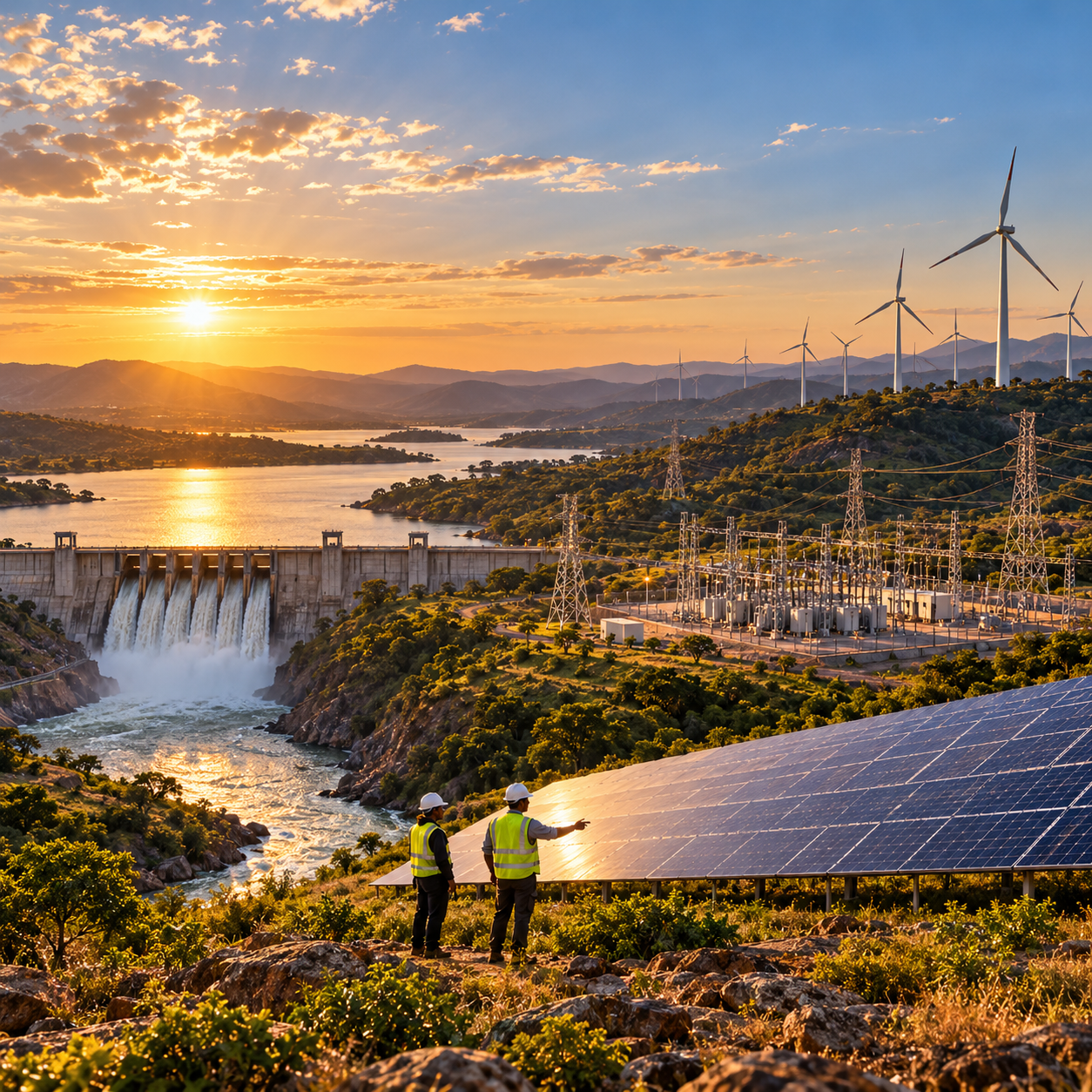
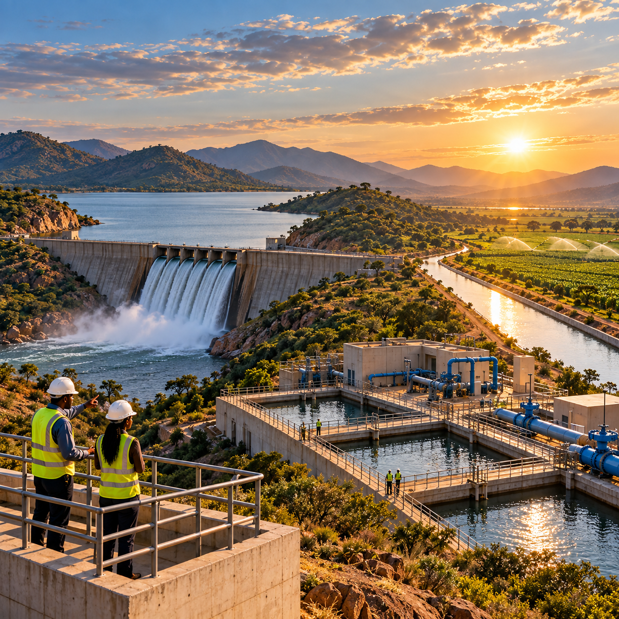
 AID Showcase